AT Days 100-109+

On Monday, June 3, we awoke early so that we could get breakfast before catching a shuttle up to Punchbowl Overlook, this time to head northbound. The shuttle was an experience in and of itself. It turns out that the shuttle vehicle was sitting at the shelter all morning while we were waiting on the driver. Additionally, there were nine people needing a ride that morning. With the driver, there were ten passengers in an 8-person vehicle. Not to mention packs. Bullfrog and another guy set about trying to lash packs to the top of the van and we crammed what we could into the back. After 30-45 minutes, we had the vehicle “loaded” and we set out to the trailhead.

We had planned a pretty long day, but the trip wasn’t to be too bad except for the last bit. The planned end of our day included a 3,000’ climb over six miles. For whatever reason, when we reached the Long Mountain Wayside at US 60, we were just exhausted and we’d just begun our climb. We were batting around the idea of hiking just a bit into the woods and stealth camping for the night, but we were all low on water and energy. Then, we looked up and the shuttle driver from Stanimals Hostel had pulled up to drop of some packs to a couple who had slackpacked that day. The trail provides! We asked him how much it would cost to shuttle us to the campsite we’d originally been aiming for and it was reasonable, so we loaded up once again.

The ride to Hog Camp Gap was entertaining. The directions included, “leave the paved road…” The driver put the vehicle into four-wheel-drive for whatever reason to go across the dirt road. I don’t really think it was necessary. The road was plenty bumpy, and the suspension on the van was about shot, so it was a tough ride. It almost seemed like the driver sped up to hit some of the bumps. Thankfully, I didn’t hit my head on the ceiling of the vehicle, but some folks did.

We finally arrived at our campsite. It was a wide open field with plenty of camping nearby. We were also expecting Paul and Austin any time. Earlier in the day we had put in an order for hotdogs because So it Goes was craving them. We set up our campsite and waited with anticipation. They arrived around 9:30, their GPS having taken them the rougher, scenic route. We helped them unload and set about building a fire to roast hotdogs. We had a great evening visiting and catching up. We also planned out the next day. Originally, they were going to walk with us a bit north and then come back to the car and head home, but we had about six miles we needed to do. The new plan was for them to walk south with us to a view, and then Paul would go back to the truck and pick us up back at Long Mountain Wayside and bring us back to the campsite. From there, we planned to continue northward to the next shelter. It was an awesome plan that would see us descending the previously mentioned climb without packs.

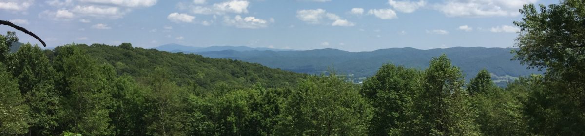
We awoke Tuesday morning and set off, sans packs. The highlight of the day, and perhaps the whole trip, was reaching the peak of Cole Mountain. It was a grassy area which afforded gorgeous views in all directions. Then came the treat. Angel’s mom had sent us individual communion cups about the size of a coffee creamer that have the wafer on top and grape juice on the bottom. We had asked Paul if he’d mind to officiate a service of Holy Communion for us and he accepted.

I think I have mentioned before that in preparation for the trip, Gavin and I listed some goals. One of those was to seek God and be inspired by Him in nature. Partaking of Holy Communion on a bald was an experience that moved me to tears. I have always had great respect for Paul as a friend and pastor, and the words he shared with us that morning were particularly inspirational and moving to all of us. I’ll always be thankful that he was there to share that moment with us.

All went well until So it Goes got sick. Really sick. She was reacting to some meds she had been taking, and they left her with dry heaves on the trail. We make it a point of not leaving anyone behind on the trail, so every little bit, we’d wait on her and Butters to be sure she was still okay. Gratefully, she was able to make it back to the road crossing, but she was definitely done for the day. The new plan was for Paul to drive us back to Hog Camp and then return to take So I Goes and Butters into town, and possibly to an urgent care. When we returned to the campsite, we decided it would be best for us to just camp for the night, and then continue northbound in the morning.

On Wednesday, our target was The Priest shelter, 14.3 miles north. The terrain was generally benign, with only small ups and downs as we followed the ridge line. We didn’t make it quite to the top of The Priest, but instead, pulled off at the nearby shelter.

The only hiccup of the day was briefly “losing” Gavin. We had stopped at the Wesley-Woolworth shelter for lunch. Bullfrog and Angel left out in front, but Gavin wasn’t ready yet. He asked for five more minutes to get his gear together and finish eating. I told him that would be okay, and he suggested that I go on ahead and he’d catch up. We have done this before, so I wasn’t worried about Gavin. Unfortunately, I hadn’t planned on a rain storm. It never really poured, but it did rain for a while. Then hikers kept passing us and we asked about Hawkeye. Most had not seen him, but if he was on trail, they’d have passed him too. Then I began to be concerned. I was able to eek out a bit of service from my phone and I called him. He said he wasn’t sure what to do about the rain, so he pitched his tent and was going to wait out the storm. He was more than a couple of miles behind us, so going back to help him get his stuff together was not in the cards. Thankfully, he calmed himself, and with the help of a fellow hiker, Swanson, he got his gear packed and came on to the shelter.

The Priest Shelter is known for its shelter logs, where hikers “confess” to sins committed on the trail. There are plenty of confessions of not digging an appropriate cat hole and other violations of Leave No Trace principles, skipping parts of the trail, as well as owning up to inappropriate relationships along the trail. It was quite entertaining to read. My confession was simple and heartfelt: “Forgive me Father – I gave a guy permission to burn a plastic bottle in my campfire last night. Afterward, I burned the plastic wrapper from our hotdogs.” To be truthful, I really did feel guilty about this transgression, and I certainly won’t repeat this action. It was good to get it off my chest, and I slept pretty well that night.

Thursday was easily our most difficult hiking day in quite a while. To start, we had to finish climbing The Priest. The trip up wasn’t difficult, but it was followed by a steep, rocky, 3,000’ descent to the Tye River. Apparently dodging rocks drenched by rain and trying to remain erect wasn’t enough of a challenge, so we got to climb up another 3,000’ to the top of Three Ridges Mtn. We passed quite a few south bound hikers that afternoon and I mentioned being afraid of the rocks we’ll find in Pennsylvania. They said that those rocks would be quite a bit like the ones I was about to get into on the climb up Three Ridges. No sooner than I had hiked a hundred yards, the terrain changed completely to some of the most difficult rocky path that I’ve been on yet. By the time we reached the top of Three Ridges, we were exhausted. To top it all off, we were mostly out of water, and there was none to be had until we reached Maupin Field shelter, still 2.9 miles away.

Thankfully, Maupin Field Shelter was downhill, and the trail down was much smoother than the one up. Gavin and I arrived well ahead of Angel and Bullfrog, so we stretched out on the grass and rested. When they got there, Angel was severely dehydrated and was done hiking for the day. Our goal had been to reach the road crossing at Reed’s Gap and to shuttle into Devil’s Backbone Brewery for a good meal and a cold beer. They told us to go on ahead and that they’d come on in the next morning so Gavin and I set out to cover the last 1.7 miles of a 15.5 mile day.

We thought the brewery would send a shuttle to the trailhead, but after a phone call on the way in, we realized that wasn’t true- they have scheduled shuttles, and we were an hour too late. They said that hitching a ride was easy from the road crossing so we continued on with that in mind. When we arrived at Reed’s Gap, there was a tarp set up and it looked like we were coming in on the tail end of trail magic. It turns out that Moosejaw Mountaineering was setting up at the brewery for the weekend to offer food and deals to hikers. The guy there offered us a ride, but while we waited for his car to come back, a car from the brewery came by so we rode in with them. Once there, we went straight to the tent site, set up our tents, hosed off briefly in the shower, and we headed to supper. It was expensive, but excellent. We started with fried pickles. I had a ribeye and baked potato, Gavin ordered a cheeseburger with fries and a baked potato. A drink and two beers later, we had run up a $70 tab. Ouch!

The whole place was wonderful. They have an outdoor amphitheater for concerts, a few outdoor bars, a fire ring, gift shop, restaurant, and breakfast restaurant. It was very cozy and we felt quite at home. They have a campground with full hookups, and they even have a tent area so that AT hikers can tent for free. This is definitely a place I’d like to go back to.

We slept well, and perhaps a bit late. For the first time ever, I laid my hiking clothes on top of my tent to dry and air out. Unfortunately, the rain started about 30 minutes before I woke up, so the clothes got soaked. I pulled on my dry “town” clothes and we walked up to the brewery for the $5 hiker breakfast. It was a bargain. There was a pancake, potatoes, sausage and bacon, and fruit. Coffee was a bit more, and they didn’t have free refills, but it was still worth the price we paid. I got in touch with Angel and Bullfrog who said they’d be there mid morning. We had planned to walk on to the next road crossing, but Angel still wasn’t feeling 100%, so we decided to just hang out at the brewery until Bullfrog’s sister got to town.

All day long, Moosejaw was doing promotional giveaways. I tried my luck at the tortilla flip, which involved a plate tied to my head and swimming flippers, but sadly, I was defeated. I was off by a few in guessing how many Cliff Bars were in the bear canister, so I missed out on winning a new sleeping pad. Then came my game: heaviest tent contest. My Big Agnes Copper Spur UL 2P tips the scales at a bit over three pounds, but since it rained the night before, it was over five pounds. I knew I’d be a shoe-in for this one. It turns out that I won by over half a pound. For my efforts, I was awarded a new Nemo Hornet UL 2P tent, about a $370 value. It is also over a pound lighter than my current tent. I’m looking forward to trying it out.

With the contests over, the four of us (Angel and Bullfrog had arrived) decided to get lunch. We had ordered and were waiting when Gavin went outside to make a phone call. He ran back in and said, “They’re making a movie and need hikers. They’ll buy our lunch.” I went out with him to see what was up, and he was right. Unfortunately, they weren’t going to pay for the lunch we just ordered. Instead, they wanted us to sit at a table, acting bored, when the “trail magic wizard” walked up, tapped his staff, and food and drinks appeared in front of all of us. We were in, and I had two lunches on Friday. In addition, they gave each of us a free beer token, but since Gavin isn’t 21, I got his too. It was a great day at Devil’s Backbone Brewery!

Bullfrog’s sister Becca came after us around 5:30 and we all went into Waynesoro for the weekend. He had booked rooms at the Super 8, which wasn’t a stellar place, but it wasn’t horrible either. On the plus side, it was just down the street from Golden Corral, so we went there for supper and got more than our money’s worth.

On Saturday, we had chores to do. It was great to have Becca there to ferry us around so we didn’t have to walk everywhere, which is often the case when we’re in town. We first went to the outfitter’s store in search of a footprint for my new tent. No luck, but Bullfrog found a few things he needed. We also headed to Walmart to resupply our food. You would think that after more than 800 miles, I’d have food figured out, but I don’t. I always wind up buying way too much stuff.

We had been in contact with Butters and So it Goes and arranged to meet them at Ming’s Chinese Buffet. It is one of the “must stop” places on the AT, but unfortunately, I was under impressed. It wasn’t bad, but I think I just wasn’t feeling Chinese food. They were staying at a hotel near ours, so Gavin and I arranged to go over and play D & D for a little while that evening. It is the first time he has ever played with someone experienced, and we both had a great time. Around 8:30, it was back to the Super 8 for a night of rest.

We had planned to have Becca drop us off at Reed’s Gap today to continue our hike, but the weather won out. It was a fairly miserable day, so we decided to stay one more night with the hope that Butters and So it Goes would head out with us. We moved to the Holiday Inn Express, where they were staying so we could plan together and take advantage of the stronger WiFi.

One of the greatest frustrations I’ve had is not being able to upload videos when I’ve been in town. It seems that no matter where we are, I just can’t get a signal strong enough to upload a video file in less than 8-12 hours. Thankfully, the signal was good at Holiday Inn, and I was able to upload one or two. We were also able to play D & D a second night, and a good time was had by all. Butters and So it Goes had decided to skip a bit of the trail and start ahead of us. Bullfrog called Yellow Truck, a guy that shuttles locally, and arranged for an 8:30 shuttle for Monday morning.

With a breakfast of coffee, cereal, and yogurt in us, we headed back to the trail at Reed’s Gap on Monday morning via the Yellow Truck. The shuttle driver was awesome. He told us, “Don’t tell me your trail name or when you started, because I won’t remember it, but tell me where you’re from and what you do.” We went around the truck sharing info, and I was surprised that he knew where Taylorsville, NC is. He was pretty familiar with western NC as a whole. He really reminded me of what my late brother-in-law would be like if he had lived to be seventy. We had a great ride, and bid each other farewell at the trailhead.

With a few exceptions, our trip for the day was fairly uneventful. The ups and downs were minimal, and we covered the 14.1 miles without much difficulty. The highlight of the day for Gavin and me was seeing our first bear. The four of us were walking down the trail and saw a couple of southbound hikers ahead that had stopped. They yelled up at us and pointed, “There’s a bear over there.” We looked right, and sure enough, there it was. He (or she, we didn’t get close enough to tell) was just chilling in the woods and eating plants and seemed completely unconcerned about us even though we were clacking our poles together and yelling to get him to move along. Eventually our two groups decided to walk toward each other, thinking that a much larger group would cause the bear to move along. It worked, sort of. It turns out that the bear did wander away from us, but before long, we came to a switchback in the trail that crossed in front of the bear again. Even closer this time. Again, he seemed unconcerned, and we walked on by. Great! Another switchback. Closer still, but thankfully, he was more concerned with food than us, and we finally left the bear behind us for good.

The other thing that made the day’s hike interesting was the presence of lots of water on the trail. The rains over the weekend had swollen creeks and the increased runoff from higher elevations had kick-started some of the itinerant creeks that poured over the trail. We came across several sections where the trail itself was a creek of varying depths because of all the rainfall. One crossing in particular, was challenging enough that Bullfrog threw a few extra rocks in the rushing water to serve as stepping stones. Mostly, we traversed the creeks fairly safely, but there were a few wet shoes by the end of the day.

When we arrived at the Paul C. Wolfe shelter, we were met with a seemingly insurmountable obstacle. The trail crosses Mill Creek just in sight of the shelter. Unfortunately, Mill Creek looked like Mill River because of all the rain, and all the rocks that were placed for stepping across were under several inches of water. We set our packs down and walked up and down stream contemplating the crossing. Of course, Gavin was already in the shelter out of earshot, so we couldn’t summon his advice on how to get across. I thought I found a way, but about halfway across, I realized that I couldn’t step out 6’ at the time, so I retreated back to the bank. Eventually, we shucked off our shoes and socks, put on our camp shoes (Crocs) and waded across.

We noticed a few people tenting, but were grateful that there were enough spots left in the shelter for us to not have to bother with setting up a tent. I filled my water bottles and went about the process of making supper. Afterward, I had a new challenge: along this part of the trail, bear poles are provided at shelters as a means of hanging food bags. Essentially, a bear pole is a 10’ metal pole with four appendages with hooks at the top. There is a second pole one uses to lift the food bag up and secure onto one of the hooks. This is great in theory, but in practice, it is no easy feat to hook the food bags onto the hooks because the bag itself obscures the view of what you’re trying to hit. Eventually our food was hung and we settled in for the night.

Tuesday’s hike to Calf Mtn. Shelter, a distance of 12.7 miles, was not too bad, except for not having water for the last seven miles of the day. Early in the day we passed a small cemetery with a few graves, mostly marked with rocks. We also passed the remnants of a small cabin. The part of the foundation and chimney are all that remain. After that, the next highlight was getting to the visitor’s center at Rockfish Gap. It was about 0.25 miles uphill, and we were hoping for more than we got, but it was worth the trip anyway. Inside, they had fresh water so we filled up for our seven mile trip onward. They also had a 3-D map of the region which showed the AT through the Shenandoah National Park and onward to Harpers Ferry. It looks like we have a pretty easy hike along the ridge line for the next 150 miles or so, as long as there are no rocky sections.

Early in the day I emailed Evan of Evan’s Backpacking Videos on YouTube to find out how he was able to upload from the trail. His biggest piece of advice was to drop from 1080p to 720p, and the resulting file size would be significantly smaller. As luck would have it, I had a few videos ready, so I tried it while we were having a hotdog below the visitor’s center. It worked. With two bars of LTE, a 720p video will upload in a reasonable amount of time. In fact, by the time we finished lunch, I had two new videos online. Score! Thanks Evan!!!

While we were at the visitor’s center, about a dozen nuns in black and white habits came in. I enjoyed talking with them and answering their questions about the trail. Outside, Bullfrog was doing the same with a few folks from Texas who worked for US Border Patrol. The exchange for them was two-way, because Bullfrog had several questions about their work as well.

After about an hour, it was time to get back on trail. Not far along, we came to a self-registration station to get permits for the SNP. Permit in hand, we were off for a parched afternoon hike through the woods. There were a couple of highlights on the trip. First, we crested Bears Den Mtn. which is home to a large set of communications towers. They also have an area out front where they’ve cemented metal tractor seats into the ground to make a seating area. Unfortunately, the grass was tall, and the underbrush had grown to cover the view, so I didn’t bother to sit down.

Shortly after, I passed through Beagle Gap. After going up a small hill through a grassy area, I reentered the woods. Only a hundred yards or so in, I met with a deer who was standing right beside the trail having a meal of the greenery nearby. I was able to get my phone out and video her for several minutes. I was about 15’ away and she didn’t seem afraid of me in the least. Though I’ve seen plenty of videos of folks quite close to wildlife, I still marvel at the lack of fear shown to hikers by these animals. It is almost as if they know that we are not a threat to them, so they pay us very little mind.

Hiking on alone, I arrived at Calf Mountain Shelter. I was concerned when I saw that the shelter was 0.3 miles off the trail over rocky terrain. I was more concerned when I saw some folks from earlier at the water source, and they said there was not much room at the shelter and that they were hiking on. Knowing that there were three more folks behind me, I was worried, because I knew that there were no marked tent sites anywhere nearby. I walked on to the shelter, and it was nearly full – save for two spaces on the top bunk. The guide indicated space for 2-3 tents, and there were already 5-8 set up nearby, so I doubted that I’d be able to pitch a tent, and neither would Bullfrog and Angel. After I stood around talking for a little while, someone hit upon a marvelous idea. This shelter had a wooden floor with an overhang to cover the picnic table. It was suggested that we move the picnic table out from under, and that folks could sleep there. This was the idea that saved me from my first night of cowboy camping (sleeping under the stars). Gavin got one of the open bunk areas at the top, and Bullfrog, Angel, and I slept on the shelter floor.

When Wednesday morning arrived, we filled up our water bottles and bladders and set out for the day. We were heading to Blackrock Hut, and there was almost no reliable water on the way. We also had to contend with a trail relocation that added a bit to our hike. Apparently there was work transpiring on a power line right of way where the trail crossed, so they relocated us down a roadway for a ways. Along the way, Gavin turned his ankle, but neither of us thought much about it because this has happened before and he has always just walked it off. He sat down on a log for a bit and told me to hike on, which I did. I caught Angel and Bullfrog a couple of miles down the trail and we hiked together for a ways. Our trail was good and flat, and we were making pretty good time. We were all surprised when we reached Turk Gap on Skyline Drive and found that we had only gone 4.4 miles. We thought we were at least 5.5 or 6 miles into the day. Though the relocation added a bit, we were still disappointed with our progress and speed so far for the day. We stopped at Turk Gap and had lunch, and a trail angel had left water there which was most appreciated. I was down to a bit over one liter and the next water source was going to be at the shelter many miles up the trail. With lunch eaten, we packed and walked on. We were surprised that Gavin hadn’t caught us, but not worried, because sometimes he takes his time and then just appears out of nowhere.

About a mile up the trail, we met our third deer on trail that day. This one was a buck, though his antlers were still a work in progress. He was a bit more timid than the does we passed earlier. He didn’t have much patience for waiting around to be filmed, though I did get some footage of him walking away down the trail. A little farther up, I started trying to call and text Gavin to find out where he was. It turns out, he was almost two miles behind us, about half a mile south of Turk Gap. He had rolled his ankle twice more and was hurting. After discussing options, we decided it was best for us all to hike back to Turk Gap to meet him and assess the damage.

When I got there, he was obviously in pain. I helped him get laid down by a rock so he could elevate his ankle and I had a look. There was some bruising and definitely some pain. I gave him some ibuprofen and when the others came, we decided to call a shuttle back to town. The Yellow Truck guy was available and was on site in just over an hour. He took us to the Urgent Care in Waynesboro and told us to call when we were ready to go to a hotel.

It took quite a while to check in at Urgent Care because their computer system was glitchy, but eventually we got registered and were called back. They took Gavin straight to X-ray, and after about thirty minutes, the doctor came in. He showed us the x-ray of Gavin’s leg and indicated that there was the possibility of a hairline fracture at the base of his right fibula. His recommendation was to go home and see an orthopedist for a second opinion.

Obviously, we were both afraid that he had suffered a hike-ending injury. The Yellow Truck came back and dropped us at the Holiday Inn Express where we had stayed previously. As he drove off, I went in to register, only to learn that they had no rooms. As luck would have it, there was a Comfort Inn across the street which did, so we all went across and got settled for the evening.

I am thankful that if we had to deal with an injury, that it was after school was out for the summer. Beth had planned to be in Asheville Thursday for a workshop, but she cancelled and was able to come get us that afternoon. It was great to see her, even though the circumstances surrounding her visit were less than optimal. On the way home, I called our doctor’s office and they would be able to see Gavin on Friday afternoon.

The trip home was scenic, and it was interesting to see some of the places where we had crossed under I-77 and I-81 on our trip. I have to say that it was nice to be home for a few days, and especially nice to sleep in my own bed with my own full-sized pillows.

Friday afternoon was crazy. We saw Gavin’s physician at 2:00 and after looking at the X-rays, he said he could see why they diagnosed a possible fracture. His recommendation to us was to visit one of two orthopedic urgent care centers in Hickory for a more thorough diagnosis. The first place we went didn’t operate as an urgent care facility on Fridays, so we went on to Mountain View. The PA there looked at the X-rays backward and forward and said that even though he could see what concerned the other two doctors, he didn’t think Gavin’s leg had a fracture at all. He diagnosed it as a mild sprain and said Gavin could hike on, wearing a brace at first.

On the way home, we looked at calendars to decide when we could return to the trail. Beth had an appointment Monday morning and Tuesday afternoon, but she could drive us back to Waynesboro Monday afternoon and be back in time for her Tuesday obligation. That is what we wound up doing.

As I sit here now, it is Tuesday and Gavin and I are still in a hotel room (our fourth hotel in Waynesboro). We should have hiked out today, but the Yellow Truck guy had another shuttle this morning, and the weather forecast was for significant rain. I’m kicking myself now, because so far, the rain hasn’t come, though I expect it to move in any time and make tomorrow’s hike miserable. As it stands now, the Yellow Truck will be here to pick us up around 9:30 Wednesday morning and we’ll start playing catch-up with Angel and Bullfrog.

Thanks for clicking in for this update of our adventure. I must say in closing that after spending a long weekend at home, it was very difficult for both Gavin and me to leave to come back to the trail. We covet your prayers now more than ever as we get back on trail. We are closing in on the halfway point of the trail, and there are many days that both of us tire of walking. That isn’t to say that we’re not enjoying ourselves. We are still seeing wonderful views and meeting great people. It is just that we miss our daily routines at home sometimes, and being home this weekend reminded us of all we have left behind to make this journey. Our goal is still to make it to Katahdin in Maine, but we can always use encouragement. Thanks for your comments and remember to just keep taking the Next Step.

AT Days 92-99

On Sunday, 5/26, we were in Daleville, VA enjoying a weekend off with Beth, Griffin, Sallie, Sarah Grace, Gabe, and Summer. Having relaxed all day Saturday trying to recover from our 26.2 mile day in town, there were chores to be done on Sunday. First and foremost, we had to find a laundromat to wash our stinky clothing. It is truly stunning to behold the smell of clothes that have been sweated in for a week. Unfortunately, our gear is not much better, and there is no good way to get funk out of a backpack. We also had to resupply our food. Those chores completed, we pretty much relaxed the rest of the day. For supper, we went back to Cracker Barrel since it was so close. We ate our fill and set into sleep for the night.

Monday was a great day. To say that Beth and Sallie have been bitten by the AT bug would be an understatement. They both wanted to spend some of the day doing trail magic, so around noon we loaded up the car and headed to the McAfee Knob parking area where the trail crosses through. They had all the usual hiker wants covered: Gatorade, Snickers, beer, water, and chips. It was really meaningful to be on the giving end of the trail magic, and we met a few hikers that we reconnected with later in the week up the trail.

After trail magic was dolled out, Sallie took Gavin and I back into town for one more night. It was a bit closer for her to make the trip than Beth. Instead of going back to the Quality Inn, though, we chose the Super 8 because it was closer to the trailhead and a nicer place to stay than the HoJo. Bullfrog and Angel came into town about an hour after we got there and it was great to reconnect with them. I find it incredible how close we have grown on the trail in only a few weeks, but we really missed having them along in the past week.

In the late afternoon, Bullfrog, Angel, and I walked about a half mile down to the Kroger to get a few food items and we were hoping to pick up a few things from the outfitter next door but they were closed for the holiday. On the way back, we decided to just order in pizza for supper and we had an early bedtime.

We slept in a bit Tuesday, but it worked out well. We were able to breakfast in the hotel lobby and from there we hiked back down to the outfitter to pick up a few needed items. By 11:00, we were back in the saddle again. We hiked a short distance to the trailhead, said our usual morning prayer, and we were off. Our goal for the day was Wilson Creek Shelter, about 11.2 miles north. It was not a very difficult hike, even though Gavin and I had been of trail for three full days. Along the way, we crossed under I-81 again, but the highlight of the trek was passing the ⅓ of the way mark. On the trail was spelled out “33.3%” in sticks and rocks, and for the math nerds, there was a bar over the final 3.

Early in the trip we crossed over a grassy pasture area and Angel had the chance to put her “mom” skills to use. Gavin sometimes has a difficult time getting back on trail, especially after seeing the family. The sour mood hit him a few miles in, and even though I tried too be encouraging to him, it just wasn’t working. Thankfully, Angel can often get him to breathe and relax, even when I can’t. So it was today. We are so thankful to have her and Bullfrog on the trail with us. We compliment each other well.

On Wednesday, we had our first crossing with the Blue Ridge Parkway at the Taylor’s Mountain Overlook. Bullfrog and Angel were already there and we waited a couple of minutes for Gavin to catch us. They all left and while I was resting, I observed a deer in the underbrush just off the overlook. I got some video that’ll be on the YouTube channel later on.

We had one of our biggest mileage days on Wednesday with a 17-mile trek. It was a mostly flat walk along a ridgeline and the primary excitement of the trip was dodging a thunderstorm just before Cove Mountain Shelter. We hustled into the shelter to allow the storm to pass, and it quickly did. From there, we headed on down to Jennings Creek to get a shuttle to Middle Creek Campground.

It was great to be in “civilization” again. The campground had a grill and the ladies that work there are incredible cooks. I had two of the best cheeseburgers I’ve had on trail, along with a couple of tall, cold beverages. We quickly retired to the bunkhouse. After a much needed shower, we settled in for a good night of sleep.

Our trip Thursday was 14 miles to the Thunder Hill Shelter. There was quite a bit of climbing involved, but thankfully the grade of the trail was reasonably gentle. Along the way, we stopped at the Bryant Ridge Shelter, which was one of the largest and newest shelters on the trail. It was built in 1992, and will sleep 20 people. It has three levels, a privy, and a nice stream running about 15 feet to the side. If it were further along the trail, I would have love to have camped there, but alas, we had more miles to do, so we had to settle with a long lunch break.

We also passed the Cornelius Creek Shelter. It was 0.1 mile off the trail, but we decided to stop and have an early supper before traveling on. While there, we met quite a few new hikers. One was Chilly Bin from New Zealand. She was great to talk to. We also met our first family on the trail, a group from New Hampshire. Mom and Dad are hiking with their three kids, aged 8, 11, and 13. I would really like to have had Gavin spend some time talking with them, but they were staying and we weren’t, even though we wanted to.

In the final part of the day, we had two different sights to see. First was the FAA radar tower at the top of Apple Orchard Mountain. It was a behemoth of a thing, a giant ball that tracks commercial flights. We also passed under the Guillotine, a rock formation that features two slabs of rock with a smaller boulder tapped between as if ready to fall. It was fun waiting on the rest of my party there and taking pictures of folks as they passed under. The only downside to waiting was being nearly eaten alive by bugs. To add excitement to the hike, there were a couple of places approaching the Guillotine that required scaling some fairly steep rocks.

Our final day of hiking this week was also a long one, at 14.8 miles, but we had a reward at the end. And at the beginning. One of the first things we passed was at incredible overlook. The view was among the best that I’ve seen. We ended our hike by crossing the James River via the James River Foot Bridge. It is the longest pedestrian only bridge on the AT and it is named for Bill Foot. Thus it is the Foot Bridge rather than a footbridge.

Once off the bridge, we waited at the parking area for Bullfrog’s dad to come pick us up. While there, we chatted with Polar Bear and just before we left, the family of five we met the day before caught up with us. We were able to talk just briefly enough to learn that they have a YouTube channel, A Mile in their Shoes. The father is a ski resort chaplain and they are trying to bring awareness to people, parenting, and poverty. I am excited to have some time to check out their videos.

Bullfrog’s dad Ken picked us up a bit before 5:00 and we headed to our hotel in Lexington, VA. It was nice to stay in a hotel and have access to a car. Even though WalMart was only 0.5-0.7 miles up, it was great to have a ride. For supper, we went to a Mexican restaurant that was outstanding. Gavin learned that he likes enchiladas, so now he has something new to order when we go out. While we were at the restaurant, we were surprised to meet up with three section hikers whom we had passed in the previous two days. In talking with them at a road crossing we learned that each year they get together and hike 100 miles of the trail. It was good talking with them and I shared our blog and YouTube addresses.

Saturday morning we loaded up the car and went to an outfitter in Lexington. I was looking for a couple for small items and some relief with my new shoes. I wound up getting some SuperFeet insoles, and I think they’ll help absorb some shock. While at the outfitters, we met Butters and So it Goes, two hikers we haven’t seen since Chatfield shelter about a month ago, though at the time I didn’t remember meeting them.

In the afternoon we ran into Butters and So it Goes again at the hotel where we were all staying. We made arrangements to all go to supper at Ruby Tuesday, and it was great to talk with them. They’re from LA. Butters hiked the Pacific Crest Trail two years ago, and they both did some of the AT last year. It turns out that they‘re doing about the same mileage as us, so we’ll likely hike with them for a while. This was especially exciting for Gavin because they both are Dungeons and Dragons players. He is hoping to start a campaign on up the trail somewhere.

On Sunday, the six of us arranged a shuttle back to Stanimals hostel in Glasgow. Actually, they dropped us at a trailhead about 10.5 miles from the hostel and took our packs so that we could slackpack that section of the trail. It was awesome, because we were able to hike down a 2,500’ hill instead of hiking up it. Early on in our slackpack day, we met Polar Bear. He had a hard time finding his way out of Punchbowl Shelter and wound up walking a mile or two the wrong way on the trail. He was fit to be tied, and vowed that he was going to hike back to the road and go home. We haven’t seen him since, so suppose he made it.

The remarkable trail feature of the day was passing a marker that was placed in the memory of Ottie Cline Powell, a not quite 5-year-old boy who wandered seven miles away from his school in search of firewood in 1891. He was obviously lost, and he succumbed to the elements near the peak of Bluff Mountain. It was difficult to think of what might have been going through his mind as he wandered through the cold, icy wilderness, hoping to find his way home.

It turned out that this was an excellent section to hike southbound. Had we been going north, we’d have started our day with a 2,500’ climb up Big Rocky Row in less than five miles. Needless to say, it was great to be going downhill without packs instead of uphill with. We ended our day back at the James River Foot Bridge parking area and were picked up by a shuttle driver for a short trip back to the hostel.

Stanimals hostel was different than any that we’ve stayed in before. Essentially, it was a house that was set up for and turned over to hikers. The “manager” lived next door. Each of the two bedrooms on the main floor had 4-6 bunks, there were private rooms upstairs, and the living room had a massage chair for hikers’ use. There was a full kitchen and laundry which we didn’t need since we had washed clothes in Lexington over the weekend. For supper, we walked a few tenths of a mile up the road to a local restaurant and had pizza.

The other remarkable sight of the day was a giant fiberglass dinosaur across the street from the restaurant. It is a left-over from a dinosaur-themed park in the area. Apparently, there used to be several such statues in the town, but alas, no longer. It had been my hope to take a group photo of our trail family, but we left the restaurant hurriedly under the threat of rain.

We are really looking forward to tomorrow. Our friends Paul and Austin are supposed to be meeting us on trail Monday night. The plan is for them to hike out and meet us on the trail and then to hike back to their truck together for some trail magic. It is always great to see folks from home, and we also enjoy reading your comments on the blog. Thanks for checking in with us and please stay tuned for the next installment. Remember to just keep taking the Next Step.

AT Days 85-91

Sunday morning we all set out for Pine Swamp Branch Shelter. Once again, the trail undulated along the ridge line, so a 12.6 mile day was not overly ambitious. Snow Cream, the early riser of our bunch, set out first, probably 30-45 minutes ahead of the rest of us. Eventually, I was out in front, ahead of Gavin and Snow Cream, and the other two. About five miles out I stopped at the junction of the Groundhog Trail to eat my lunch. There was a southbound hiker who was doing a 22-mile slackpack trip back to the hostel that I visited with briefly. Before I finished lunch, Gavin had caught up and Snow Cream wasn’t far behind. We didn’t know how far back Bullfrog and Ken were, but we knew they’d be a bit slower while Ken was getting into hiking shape. After lunch, we all headed on down the trail aiming for the Pine Branch Shelter. Gavin eventually took the lead and got quite a distance ahead of me. On the final descent to the shelter, I was crossing over a blowdown and just as I was landing my step, I noticed a rather large black snake slithering off the trail. Needless to say, I was quite surprised and took a somewhat longer step than is my normal stride. Generally, I am fairly at ease with snakes, but I don’t like to be surprised by them, and this one was definitely that. I moved quickly on to the shelter and set about blowing up my air mattress to relax for a while.

Several hikers passed by the shelter that afternoon, but none remembered passing Bullfrog and Ken. Snow Cream came in about an hour after I arrived and he hadn’t seen them either. I figured that the distance covered that day was a bit much for someone just getting back into the woods, and resolved myself to the fact that they probably wouldn’t make it that far.

While I was resting, a volunteer from the Roanoke Appalachian Trail Club came to the shelter. She was on a recon mission ahead of bringing a team of university students up in the coming week to do trail maintenance. As I have done countless times in my videos, I thanked her profusely for all the work she and others have done to keep the trail passable. She asked if there were any nearby issues and I told her the only problem I had was climbing under a blowdown a few miles south of the shelter. Snow Cream confirmed that he had the same issue. She said that they had been discussing that tree, but would go ahead and cut it in the next week. She also had the most plausible explanation for how the bear got Snow Cream’s food at the Hurricane Shelter. She indicated that they have one or two bears that will climb on a limb above the food bag and then drop down, grabbing the bag on the way to break their fall. That is certainly more realistic than the bear climbing out the limb and pulling the bag up by the rope, which to this point was our best guess.

Monday’s 12.7 mile hike involved a small climb at the beginning, before traversing a fairly flat section for several miles. The end of the day involved a slight descent to the War Spur Shelter. What the guide didn’t tell us was that the fairly flat part was riddled with Volkswagen-sized rocks that had to be climbed over or around. Actually, these rocks weren’t the most challenging ones we’ve encountered. I was able to get up on top and bounce from rock to rock without losing much of my stride. I am, however, thankful that I didn’t miss a step because that could have been painful. Right out in the middle of the rocks I met up with a hiker I had heard about, Iron Man. He is a 79-year-old Englishman who is hiking the trail this year. When he heard me coming, trekking poles clicking on the stones, he turned around and said, “Bloody rocks!” We laughed and chatted for a while before I passed by and headed on to the water source a mile or so up the trail.

The highlight of the day was, ironically, at mile 666. I was bee-bopping along the trail at a pretty good clip when I pulled up within a step of a 3’ timber rattlesnake who was sunning itself across the trail. After checking my pants and uttering a few expletives, I stood and waited for the snake to go on across and off the trail. It was a long wait. A fellow hiker, Curly, came up and we took turns watching and videoing from a safe distance. Gavin hiked in just in time to see the snake head off into the underbrush, but he was able to get a good look. All I could think of the whole time was that I was one step away from a really bad day.

The other highlight of the day was seeing hundreds of beetles on the trail. I’m not exactly sure what kind they were, but they were black, about ¾” long and they were out in droves. Apparently it was mating season for these guys, as we kept walking by piles of them as we went up the trail. As we’d step, they’d scatter to get out of the way, and then they were right back on the trail. Walking along, even the leaves were rustling with the thousands of beetles busy securing the furtherance of their species. It sounded like someone crinkling a handful of plastic wrap. I had the thought, and several other hikers later said the same thing, that it reminded them of the movie The Mummy.

Tuesday’s hike featured two big climbs, one right out of the gate to the view at Kelly Knob. This was a nearly 1,800’ trip to start our day. The view was good from a large rock outcropping. The rocks were in sections with gaps between that reached all the way to the ground 20-30’ below. Gavin wanted to go out on some of the farther ones across the crevasses, but I suggested to him that the rewards might not outweigh the risk. After looking down in the cracks, he agreed to snack and view from terra firma.

Midway through the day we stopped at the Laurel Creek Shelter to eat lunch and refill our water. One unusual feature of the afternoon hike was passing through pasture land for about two miles. I was grateful to the landowner for allowing the trail to pass over his property, but more thankful that he had mowed a 5’ strip on either side of the trail so that we weren’t walking in waist high grass. It was a beautiful area and we could see for miles all around. Near the end of the farmland was a swampy section where about 100’ of split log “bridge” had been laid. These little details of trail maintenance never cease to impress me.

One of the notable trail features that we passed on Monday is the Keffer Oak. This is the largest oak tree on the southern part of the AT, boasting a circumference of nearly 19.6 feet. It is 60’ tall and has monstrous limbs. From there, we began our second climb of the day onward to Sarver Hollow Shelter.

The shelter area was busier than usual. Iron Man came in after us, as did several other hikers that we knew and some that we didn’t. Most folks tented, but once again I braved the mosquitoes and opted for the convenience of the shelter. There was a large grassy area out in front and there was also a comfortable bench to sit and read in. One of the nice bonuses of this shelter was a tree right out front from which to hang our food for the night. Sometimes we have to search for 5-10 minutes in the woods around the shelter, so when you find one so quickly and close by, it is a major accomplishment.

I have to say that I’m very pleased with our daily mileage for the week. Three 12+ days and a 16.1 trip to Pickle Branch Shelter today is our best four-day combined total yet. The early part of the day was a nice ridge walk followed by a downhill section. We made great time on this part of the trail. Then the hammer dropped. We had a 1,500’ climb that stretched over three miles. The first part of it wasn’t too bad, but near the end, it felt like we would never stop going uphill. At the top, we were rewarded by the Audie Murphy memorial. Murphy is the most decorated American soldier of WWII. He was killed in a plane crash just off the AT in 1971 and the VFW Post 5311 constructed a memorial near the crash site in his honor. There is a large marble tablet and a flagpole. Around the monument is a stack of rocks that hikers have placed there in remembrance, as well as flags, dog tags, medallions, and other military-themed memorabilia. I must admit that I felt as if I were standing on hallowed ground.

Just before the long climb up to the memorial, I realized that Gavin didn’t have much water, so I sent him a few tenths back to the stream to fill his bottles. I felt like I hiked especially strongly on Wednesday, and when I reached the monument, I expected him to be 30-40 minutes behind. I had no more than taken my pack off and sat down on a bench to say a prayer of thanks and remembrance to those who lost their lives in WWII when up pops Gavin. He was no more than 5-10 minutes behind me. This is a testament to his hiking ability- I continue to be amazed at what a strong hiker he has become in the past three months. All the hikers we have met have been complimentary of his speed and endurance. I believe that he is fully capable of keeping up with the many twenty-somethings that we have met on the trail, and that is a terrific compliment.

We were thankful that the last five miles to the shelter were mostly downhill. Unfortunately, the shelter was 0.3 miles off the trail, but it was nowhere near as difficult a trip as was the 0.4 downhill trip to the Sarver Hollow shelter the night before. The water source for the shelter was a nice stream, but it was an additional 0.2 miles, downhill. I really like it best when shelters are on trail and the water is very close by. Unfortunately, these are few and far between.

To reward ourselves for the past four longer days, we only planned to hike 6.7 miles on Thursday. Four Pines Hostel was just a bit off the trail at a road crossing, and there was a gas station with food and resupply items a few tenths of a mile down the road in the other direction. One highlight of Thursday’s hike was crossing the 700-mile mark. Three times. For whatever reason, there three places on the trail that were marked as 700-mile point. I checked the last one in the Guthooks app which reported my location as 700.5. The day’s hike also included the first landmark of the Virginia Triple Crown: Dragon’s Tooth. We had a 1,500’ climb to get there, but it was a marvelous sight. Dragon’s Tooth is a large rock spire that sticks out of the ground on a ridge. It can be climbed, but I would consider it perilous, and if you fell off the wrong side, it would take you a long time to hit the ground on the other side. I opted to just take a few videos and leave it at that.

The fun part of the day was descending the ridge line from Dragon’s Tooth. It was the most difficult, technical mile of our entire trip so far. The trip down included several places where steel “handles” had been cemented into the rock because there was nowhere to step or grab. It also included some other places where there should have been steel helpers. One particular part was on an 8-10’ nearly vertical rock face with only a 2-3” crack to walk along as you zig-zag your way down. Even after the steeper, more vertical descents, we still had to contend with rock-hopping for nearly a mile. When we finally reached the bottom, we saw a sign for the south bound day hikers who would have to ascend this treacherous trail: “Caution: The next mile of trail is rocky and steep in sections. Please use caution and follow white blazes carefully.” I cannot repeat here what I thought when I saw that sign, but the common phrase invoked the name Sherlock.

Finally, we reached the road crossing at trail mile 704. We had to make a choice: go on to the hostel to the right, or go get food and drinks to the left. The distance was about the same either way. We opted for the food and Gatorade option. The gas station has hot dogs, hamburgers, and pizza so we decided to have lunch. While we were sitting outside at a table, the owner of Four Pines Hostel drove up to get his lunch. He offered to drive us back when he finished eating. I cannot remember a time when I have been more grateful to have a ride somewhere!

Four Pines is a hostel in a 3-car garage. Half of the space is set up as a common area, with couches and tables and chairs. The other side houses 14-16 bunks for sleepy hikers. Outside there were chickens and guineas running around everywhere, along with a few cats and dogs. Though we were “warned” that it might not be the most family friendly hostel on the trail, we found it to be quite pleasant. Before the afternoon was up, the place was full of hikers, and several folks slept on the couches or in tents outside. Though there was only one bathroom/shower and no towels, it was still quite nice to get cleaned up. There was also a washing machine, which my clothing severely needed, and a clothes line out back.

Perhaps the best part of staying at Four Pines is that they shuttle you to dinner at the Homeplace Restaurant nearby. They serve southern comfort food family style. You get chicken and your choice of two or three other meats, and delicious vegetables. I ate my fill of roast beef, pulled pork, green beans, mashed potatoes, baked apples, pinto beans and the best coleslaw I’ve ever tasted. To top it off, they had blueberry cobbler, a la mode. They just kept bringing more bowls and plates of food. It was the best food experience on the trip yet!

I slept fitfully at Four Pines, and apparently I snored a bit. At some point in the night, the hiker in the bunk beside me poked me with a trekking pole and said, “Could you roll over or something?” I apologized to her the next morning for waking her up. She accepted, but I’m not sure she forgave me.

Friday was a day of decisions. Several folks were planning to slackpack on into Daleville, a distance of 26.2 miles. I considered this crazy, since our best day was just shy of 18 miles, but we were hoping to get on into town as early Saturday morning as possible to see Beth, Griffin, Joy, and Sallie and her crowd. I looked over both my trail guides for a place we could hike to in between the hostel and town where Beth could pick up our packs Saturday morning and allow us to slackpack on in, but there was not a convenient road crossing. Finally, we settled on hiking to Lamberts Meadow Shelter, 16.4 miles upward, which would leave us only 9.4 miles into town on Saturday morning. This trip included the other two points of the VA Triple Crown, McAfee Knob and Tinker Cliffs.

We set out with full bags of water because there was to be little available on the trail in this section. McAfee knob is probably the most photographed viewpoint on the AT, and it was 9.6 miles ahead of us. The climb up was actually not difficult. I believe the trail is intentionally graded for day hikers, because there were tons of those. I’m quite sure that if we had reached the top earlier in the day it would have been swarming with people. The views from the ledge atop McAfee Knob were stunning. There is a section of rock that overhangs the valley below where one can take a “Lion King” photo. Even though it looks like you’re thousands of feet up off the valley floor, the rock ledge is only 40-50’ off the ground below. That is still quite a long ways to fall, but surviving the fall might be possible if you landed properly in the trees underneath. If it were as high as it looks, though, at least you’d have time to say a lengthy prayer before hitting the ground below.

With McAfee Knob checked off the list, it was onward to Pig Farm campsite to fill our water bottles before continuing onward to Tinker Cliffs. I was pleasantly surprised by this trail feature. When I see the word “cliff,” I think of treacherous terrain and long falls. I was pleased to find that even though there are steep cliffs, you don’t have to walk right along the edge. As we were going along this section of trail we observed several turkey buzzards drifting around effortlessly in the sky. It was majestic to behold.

With the last of the Triple Crown behind us, the only thing left to do was get on down to Lamberts Meadow Shelter, eat and sleep, and get up and head on into town to see the family. Along the way, Gavin got this crazy idea: “Why don’t we go on into town tonight?” The rational part of my brain told me this was an absolutely insane proposition because, including the road walk from the hostel to the trail head, it would make for a full marathon: 26.2 miles. Along the way, we talked about it, and I was trying to figure our best pace and what time it would be when we got there. When we arrived at the shelter, we sat down, took stock of how battered our bodies were feeling, and filled our water. Looking at the terrain, it should be an easy walk, and we should be able to average 3+ miles/hr. That meant it wouldn’t be midnight when we got there, more like 9:30-10:00. Against my better judgement, we decided to go ahead with the trip.

We were able to make the pace we thought for most of the trip, but about five miles out, the trail turned rocky. And dark. We donned our headlamps and paced onward. Finally, we reached a section of the trail with so many sharp rocks and small climbs that I questioned our decision. We got through it, but it wasn’t pleasant. We also ran out of water about two miles from town, and I think we were both about to run out of gas for walking. We had hoped to surprise everyone when we got to the road by calling and having them come pick us up, but about halfway along Beth called and she didn’t understand why were still hiking at 9:00 at night so we told.

When we got near to the roadway, Gavin called again to muster the minivan. While he was on the phone, he got a bit ahead of me and he came to a trail junction. One way was to the “park and walk” area, and the other continued down the trail to the road. When I got to the sign, I had no idea which way he went. I took what looked like the correct trail, but after a few hundred yards of not seeing a blaze, I turned back to have another look at the crossing. Still no Gavin, but the other direction had blazes so I continued onward, hoping he was in front of me. Finally I reached the road, still without sight of Gavin or any of our transportation. I got a bit panicky and called him on the phone to ask where on earth he was. It turns out that he took the path I had started down which went a short distance to a parking lot. It was a tenth or two miles down the roadway where I came out. I finally managed to figure out where everyone was and I parked myself in a gas station parking lot to await a ride. Not long after, I heard Sallie calling out so I walked to meet her.

It turns out that when Gavin got to the car and I didn’t, Beth took his headlamp and headed up the trail he came in on to look for me. Without her phone. By this point in the day (night) I was tired and furious. I jumped on him pretty hard for leaving me behind after I had asked him earlier in the evening to stay close in the dark. I know I hurt his feelings, and that he only walked ahead because he was excited, so I apologized a bit later. I think he understood my frustration. Meanwhile, Sallie took my light and went back up into the woods to find Beth. Eventually we all got together in one place and we headed back to the hotel. I honestly don’t know where I summoned the energy to walk up the stairs one flight to our room. I am only thankful that our room was right at the top of the stairs rather than all the way down the hallway.

Once in the room, it didn’t take me long to get into a hot shower and clean clothing. Needless to say, I slept like a baby Friday night. I almost didn’t make it up to get the breakfast that was included in the price of our stay. I am thankful that I did, because real coffee tasted so good, and it has been quite a while since I have had it.

Most of the day has been spent in the hotel room catching up on the blog. We did take some time out this morning to visit the local outfitter. It was quite an expensive trip. Gavin and I both needed new shoes. I also had to buy a new pack because I’ve lost so much weight that the one I started the trail with didn’t fit properly any more. For a price, they were also able to solve the “sweating in a 25° bag” problem with a 40° quilt that weighs only a pound. Even though it was a pricey trip, I’m pleased with my purchases and am excited to try them out. But not too excited. I’m going to sleep indoors for two more nights, and with this blog entry completed, I mostly have the day off tomorrow except for a resupply run that I hope will be brief and what I hope will be a quick trip to a laundromat.

It was truly fantastic having some time to spend with our family. We are also hopeful that we’ll be rejoining our trail family soon, as we head out from Daleville or just beyond. We appreciate you for following our progress and encourage you to keep sending us comments. Finally, always remember to just keep taking the Next Step.