Trail Names

In my last video/blog, I mentioned that our dog Joy had officially earned her trail name. This is an alias that one goes by on the trail. Sometimes one shows up to the trail with his or her trail name already figured out, as was the case for Mighty Blue (aka Steve Adams, whose books and podcast I’ve recommended.) More often than not, though, a trail name is bestowed on its recipient by other hikers based on some action performed, a particular character trait, or the hiker’s appearance. For example, Joy’s trail name, Zig-Zag, was given to her because of her propensity to zig and zag from side to side along the trail instead of walking straight ahead. By walking so many “hypotenuses,” she winds up covering more distance than either Gavin or I.

Skunk Butt Hemorrhoid

The reason I mention trail names is that I’ve been thinking about whether or not I would rather show up with a name or take my chances on being given one. Beth suggested that I call myself “Skunk Butt.” I have been led to believe she is less than enamored by my beard and this name is a jab at the significant grey stripe down its front. I told her I could stick my tongue out a little and be called “Skunk Butt Hemorrhoid.” For some reason, she didn’t think that was funny.

When I was naming this blog I decided to call it “The Next Step” because that is what it represents. This website is the narrative of what comes next after my retirement from teaching. Lately I have been thinking about the name in another way. Certainly, the AT is the next step along my journey, but it is also a reminder that all I have to do to be successful in my trip is just take the next step, and the next, and so forth.

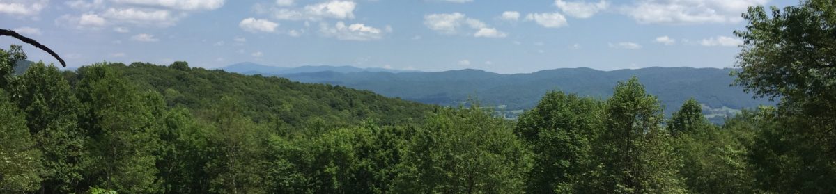
So many successful thru-hikers whose stories I’ve read or have watched on YouTube emphasize the importance of setting small goals. To start the AT in north Georgia with only the goal being summiting Katahdin seems insurmountable; the goals need to be smaller and achieved more frequently to provide encouragement along the way. For many hikers, reaching each of the 14 state lines crossed by the trail represents the accomplishment of a goal. I guess this is why Virginia becomes such a slog for many hikers that they refer to the “Virginia Blues.” This is because about one-fourth of the total miles of the AT are contained within this state. The trail through Virginia goes on and on, following the Blue Ridge Parkway, then Skyline Drive, and finally heading through the Shenandoahs. Because of the trail’s length in this state, the attainment of these mini-goals that pass more quickly when traveling in other states is slowed dramatically. Especially in Virginia, smaller goals are necessary to provide the encouragement needed to continue the journey.

Hikers rejoice at reaching 100-mile marks along the trail. Generally, these are marked along the trail with sticks or rocks spelling out 3-0-0 or 1-2-0-0. Northbound (NOBO) hikers get really excited when they start running into the SOBO’s mile markers because they start counting down the distance remaining to Katahdin. There will be plenty of such markers throughout Virginia to keep things moving up the trail.

Breaking it down even further, most hikers travel with The Appalachian Trail Guide by David Miller and/or the Guthooks trail app, both of which cite trail landmarks every few tenths of a mile or so. These may be side trails, water sources, shelters, campsites, or road crossings. These resources, rather than map and compass, are the navigation tools of thru-hikers. Most spend time in the evenings looking at the trail ahead to plan out the next day’s miles. To decide that I’m going to end the day at such and such a shelter, and making it there by dark, represents the satisfaction of another, though smaller, goal. Smaller still is the task of reaching the particular fire tower, shelter, or overlook where one plans to have lunch or a snack. Thus, reaching Katahdin is only accomplished by first meeting each of the innumerable small goals set in place that are the stepping stones toward the final objective.

To be truthful, I have actually been looking forward to seeing what trail name might be hung on me. I certainly make plenty of bonehead mistakes, I am tall, and I’ll be hiking at the age of 52. Each of these characteristics leaves the door wide open for numerous possible names which would at the very least make some people laugh, even if I was not among those seeing the humor. Here lately, though, I have given serious consideration to adopting the name “Next Step.” It is the smallest goal of all, and hearing it daily should prod me along the way toward reaching the final summit. Most certainly, when the weather is rain for a week with barely above freezing temperatures, and the trail is thousands of feet of incline, I will need all the encouragement I can get. The good news is, I still have a few months to ruminate over this decision.

South Mountains State Park

Wednesday, October 17, 2018

It is Wednesday evening and Gavin, Joy, and I have made camp. Our hike today was short (1.5 mi/302 ft. elevation gain) because we didn’t leave until 4:00. We are staying at the Shinny Creek Campsite tonight, which is only a little over a mile from the parking area. Our trip into the campsite was a gradual uphill and I was pleased that I only had to stop once or twice to get my breath. I weighed this week and I was not happy with the result. I am really going to need to do some walking before we set out on the trail for real. I have watched video after video about how tough the 600+ stairs up Amicalola falls are, and for that matter, the whole of Georgia seems to be more mountainous than on would expect.

As we came into the parking lot we observed a couple of folks who had been trout fishing in the streams here, and as we got underway we saw a couple of guys that were still in the river. For about half our trip today we followed along a creek that had several waterfalls. It was really nice. I’ve only been here once, so I’m not sure what to expect in the way of views on our trip tomorrow. I am hopeful that we’ll be able to see the waterfall. I’ll have to check our map again and see if that trail is the one we’re following tomorrow.

Speaking of maps, I had a devil of a time following the map today, and I recall having the same difficulty the last time I was here. I’m not sure what to make of that. Maybe we just wound up going a different way than I had planned to reach this campsite. I’m going to sit down in the morning and study over that a bit more carefully. 

On our Black Balsam Knob hike, I had plotted our route methodically on AllTrails.com. I tried to do the same here, but not all the park’s trails are identified by the AllTrails website. I’ll have to give that another look when I get home. It was nice, however, to get a fairly large map at the Visitor’s Center when we registered. The one I printed off the website was a bit small and difficult to read. Neither is topographic, and that would be a nice feature.

It is now 8:30, and it has been dark for 45 minutes or so. Gavin and Joy are in their tent a few feet away from mine. He turned in at 8:00, but I suspect he is playing games on his phone. I think I will do the same. Thanks for joining us.

Thursday, October 18, 2018

Today was a personal best for Gav and me. We did 8 miles and climbed 1,729 feet. I am pleased that our average pace was 25:33/mile, so we’re beating the 2mph mark. I was afraid that as out of shape as I am that this would be tough to do. 

We didn’t pass many views today, but the ones we did have were pretty nice. There was one where we could see Table Rock off in the distance. We all hiked pretty well today, but on the uphill sections I slowed miserably. I cut my stride to a heel-to-toe and plodded along. I finally put into practice today a tip that I’ve seen on some of the hiking videos I’ve spent hours watching: set mini-goals for yourself. Today our trail was along a roadbed and every 50-100 feet or so, there was a water break cut into the trail. This is a semi-flat, lipped section that catches water coming down the trail and diverts it off to the side to prevent erosion. There were times today when each of these water breaks was a mini-goal. When I’d reach the next one, I’d lean over on my trekking poles and catch my breath. Then I’d eye the next one and head off uphill. I remarked to Gavin several times today that I can do level and reasonable downhill trail all day long, but the uphill sections get me every time. I guess I need to start hiking the Duncan Death Hill, as Beth and the Mitchells call it, to get in better hiking shape.

I slept really well last night, too well, in fact. Even though I had lights out by 9:00 or thereabouts, I still didn’t respond well to my 8:00 alarm this morning. I believe it was after 10:00 before either of us got up. (I’m sure Beth isn’t surprised to hear this.) We didn’t start hiking until a little after 12:00. We are going to have to get better at this before the trail or we’ll never make it to Maine.

I am impressed at how well Joy did today. We’ve had issues before with her hiking boots slipping under her dewclaw and rubbing on her forelegs. To combat that, we got some of that stretchy tape that looked like crepe paper to wrap her lower legs and it seemed to do the trick, or so we thought. When we got to camp this evening, I noticed that the tape had pulled down on one paw and she had a pretty bad rub. We’ll have to give her some extra TLC tomorrow, and we’ll have to tape a little higher up. Even though Joy isn’t going to get to come with us on the AT, she does now have an official trail name— Zig Zag. I mentioned above that Gavin and I did 8 miles today. I’m sure Joy did closer to 9-10 because she kept swerving from one side of the trail to the other. It was a rare occurrence for her to just walk straight up the trail. Her hiking leash is pretty cool. It is about 8’ long and has elastic sewn into the lower part of the leash. That way when she pulls on it, it doesn’t jerk her or whomever is leading her. The upper end of the leash has an adjustable loop. It can be as small as a regular dog leash loop, but you can make the loop bigger and snap it around your waist. Hands-free dog walking! The down side to having her attached to you in this way is that she likes to pull when going downhill. If we can just get her trained to switch to pulling on uphills, then I’d think we’d have something!

The campsites at South Mountains State Park are pretty cool. The two we’ve stayed at have been grassy areas about the size of a football field. Each has 4 designated campsite areas with a picnic table and a fire ring. They also have privies. It is a great relief (no pun intended) to not have to dig a “cat hole” for doing your business. In addition, they have bear boxes. These are big, locking metal containers for storing your food and other “smellables.” If you followed us on our last hike, then you know we had a bit of difficulty with a bear whose parents I’m sure never married. I’m definitely going to ask in the ranger station how many people can camp up here because I think it would be a great place for our troop to backpack.

It seems odd to say that I’m sleepy at only 7:45, but I believe I’m going to sign off and retire to the warmth of my sleeping bag. I didn’t check the weather the day or two immediately before this trip, but the last time I checked, the low tonight was supposed to be around 40°. That is likely going to make it quite difficult to get up out of my bag in the morning, but I’ll do the best I can.

Friday, October 19, 2018

I’d like to say we were up and at ‘em this morning, but that is not the case. We got up around 10:00 and had our usual breakfast of oatmeal and coffee/hot chocolate. I noticed later in the morning as I was running out of gas that we really need to add some protein into this meal to give us the extra umph we need to get up and over climbs. I’ve heard of people stirring a spoonful or two of peanut butter into their oatmeal and I’m not really sure what I think about this. I’ll have to give it a try at home first in case I create a concoction that turns out to be inedible. 

We had a pretty easy hike out this morning, but once again we got a bit turned around on the trails. Based on signs, the quickest way out is to backtrack about 0.2 to the Chestnut Overlook Trail, which we did, but the trail signs there didn’t mention the parking area. Soooo… we turned around and went back the way we came. Our hike out was a pretty easy 4.5 miles out with only 443’ of elevation gain.

I didn’t take many videos or photos today because we were really interested in getting back to the parking lot. A teacher friend of mine had her elementary school class at South Mountains on a field trip and I was hoping we could meet her, but alas, because of our late start we didn’t get back to the car until around 1:30. All in all, I think Gavin and I both would classify this trip as a success.

When I got home, I started comparing the park map with AllTrails and REI’s Hiking Project. Many of the trails are missing on AllTrails which lead to much of the directional confusion. They seem to be there on Hiking Project, so maybe I need to be looking at that app a bit more. The one advantage of AllTrails is that it has point-to-point mileages listed on its maps. The park map has overall trail mileage for each trail, but not junction to junction mileage. Because we were hopping off one trail and onto another, it was really difficult to plan. Thankfully, when we get on the AT, we’ll have the Guthook’s App which shows everything in great detail. We’ll also have the advantage of not having to switch trails.

I appreciate you for following along. I hope you’ll check out our video of this trip on YouTube. Before this trip I purchased Luma-Fusion which is supposed to be a more full-featured video editing program than iMovie. It has taken me several hours to figure out the software, but I believe this video is much better than any of our previous ones.

If You Want to Know More About the AT

As Gavin and I prepare for our long trip through the woods, there are many resources that we have been studying. I believe in being informed, so for the past two years, I have read books, read web pages, and watched videos nonstop. For any readers who might be interested in learning more about the Appalachian trail, I thought I would share some of my favorite resources. Specifically, this post will be about some of the many books I’ve read and enjoyed.

A Walk in the Woods by Bill Bryson
This is the first book I read about the Appalachian Trail and it rekindled my interest in completing a thru-hike. As a youngster, I took several short trips on the trail, and even then, I thought it would be loads of fun to hike the whole trail from start to finish. In fact, in cleaning up my laundry room a few weeks ago in case the hurricane caused flooding, I found my high school book bag. It had several patches from some early scouting events, but front and center was an Appalachian Trail Maine to Georgia patch. If you haven’t read Bryson’s book, I highly recommend it. At a rather advanced age (and weight), Bryson decides he wants to hike the whole trail. In searching for someone to hike with him, he accepts, as a last resort, a high school classmate whom some would say “had let himself go.” The story itself details the many trials and tribulations faced by the pair as they set out on their first ever hike. It is incredibly funny, and it provides some information about what one might expect in completing a thru-hike. A Walk in the Woods was also turned into a movie, but I would highly recommend against the movie, even if you are a Robert Redford fan. It is without a doubt the worst book-to-movie transition I have ever witnessed.

I have no idea in what order I read each of the following books, but each was exceptional for its own reason. Many of these are stories of the authors’ trips, while others offer how-to advice. I would recommend any of these for folks who are interested in learning about the trail.

My Appalachian Trial I: Three Weddings and a Sabbatical and My Appalachian Trial II: Creaking Geezer, Hidden Flagon by Steve Adams
These are two of my favorite AT books. Steve “Mighty Blue” Adams is a 60+ Brit who, in his third marriage, confesses to, “drinking far more than was strictly necessary.” His dry wit permeates the whole book. While describing the trail, he provides much information on things he learned as a first-time hiker. I’m not sure he had even slept in a tent before ending his first day atop Springer Mountain. I also recommend Hiking the Appalachian Trail is Easy: Especially if You’ve Never Hiked Before and his podcast. The podcasts are divided into two-parts. In the first part, Steve interviews a notable hiker, and in the second, he reads a chapter from My Appalachian Trial. Once you finish the podcasts at mightyblueontheat.com, you will also have “read” both of his books. These books I have read twice, and I’ve only recently started listening to the the podcast.

AWOL on the Appalachian Trial, David “AWOL” Miller
This is David Miller’s story about his thru-hike. It is an enjoyable read and I finished it quickly. I would also note that after the trail, Miller has been publishing The AT Guide, known to hikers as AWOL’s Guide. This book lists landmarks, summits, water sources, shelters, hostels, and many other features of the trail. In addition, it has maps and descriptions of towns that are close to the trail so hikers can plan resupplies and lodging. It is available in NOBO and SOBO versions, and each describes the trail from start to finish. The guide lists points of interest with both mileage from Springer Mtn. and to Katahdin, elevations, and in the case of road crossing, GPS coordinates. Very few hikers start the trail these days without this guidebook. I enjoyed reading about AWOL’s trip along the trail, but The AT Guide is a godsend in terms of planning for the trip.

Lost on the Appalachian Trail, Kyle Rohrig
This book is the subject of Kyle’s journey with his dog Katana on a north-bound hike of the AT. It is a great story, but Kyle caught a bunch of grief for taking Katana to the summit of Katahdin, even though dogs are strictly forbidden in Baxter State Park. While I understand his argument that Katana had been with him the whole trip, thus earning the “right” to summit, I believe that hikers have a duty to respect the trail and the few rules that have been put in place to ensure its enjoyment for future generations of hikers.

Grandma Gatewood Walks, Ben Montgomery
Emma Gatewood is the first woman to hike the Appalachian Trail. She began her trip in 1955, at the age of 67, after telling her grown children that she was, “going for a walk.” She hiked the trail twice more, in 1960, and in 1963. Grandma Gatewood certainly didn’t have the luxury of ultra-lightweight gear that we have today. In fact, she hiked the trail in Ked’s tennis shoes, and carried her gear, including a wool blanket, in a bag slung over her shoulder. It is an absolutely remarkable story that I would recommend to anyone.

There are several other “trail story” books that I’ve read. To avoid the risk of redundancy in my descriptions, I’ll simply list title and author.

Becoming Odyssa: Adventures on the Appalachian Trail, Jennifer Pharr Davis
Skywalker—Close Encounters on the Appalachian Trail, Bill Walker
Where’s the Next Shelter, Gary Sizer
Balancing on Blue, Keith Foskett

The other type of book that has been invaluable is the “how-to” type of books. Here are three that I have found particularly useful.

Take a Thru-Hike: Dixie’s How-to Guide for Hiking the Appalachian Trail, Jessica “Dixie” Mills
Jessica Mills, or Dixie, is a 2015 AT thru-hiker. She is famous for her website and YouTube channel Homemade Wanderlust. She is now an aspiring triple-crowned. She completed the Pacific Crest Trail in 2017, and her YouTube channels shows that she is 25 episodes into completing the Continental Divide Trail. She is an authority on backpacking, and this book is the first of the “how-to” books I read. It is also one that I have read a second time as my trip draws nearer, and I am a regular visitor to her YouTube channel.

Appalachian Trials: The Psychological and Emotional Guide to Successfully Thru-Hiking the Appalachian Trail, Zach Davis
This is another book that I have recently reread. As its title implies, this one prepares the reader for the mental side of hiking the trail, which I’ve heard is a much harder battle than the physical one. One early piece of advice that Davis (and Dixie) give is, “to tell everyone,” and was the impetus for starting this blog. Another suggestion is to make lists such as, “I am hiking the AT because…” and “When I successfully thru-hike the AT I will…,” and “If I give up on the AT I will…” I will certainly take this book and my lists, in ebook form, on the AT to help me through those days on end when it is 30° and raining.

How to Hike the Appalachian Trail: A Comprehensive Guide to Plan and Prepare for a Successful Thru-Hike, Chris Cage
Cage’s book has chapters devoted to specific aspects of planning for and executing a thru-hike. He also includes a state-by-state guide to the trail. For each state, he gives a general overview of the trail and tells how many miles of the trail reside in the state in question. Like the many others, this is a book that I’ll take with me on the trail.

Thanks for enduring to the end of this article. I’ve been working on it for about a week, and though it may interest only a few people, I felt like I needed to write it. I am also planning a post about different YouTubers that I’ve been following for those of you who prefer moving pictures to the printed word.