AT Days 85-91

Sunday morning we all set out for Pine Swamp Branch Shelter. Once again, the trail undulated along the ridge line, so a 12.6 mile day was not overly ambitious. Snow Cream, the early riser of our bunch, set out first, probably 30-45 minutes ahead of the rest of us. Eventually, I was out in front, ahead of Gavin and Snow Cream, and the other two. About five miles out I stopped at the junction of the Groundhog Trail to eat my lunch. There was a southbound hiker who was doing a 22-mile slackpack trip back to the hostel that I visited with briefly. Before I finished lunch, Gavin had caught up and Snow Cream wasn’t far behind. We didn’t know how far back Bullfrog and Ken were, but we knew they’d be a bit slower while Ken was getting into hiking shape. After lunch, we all headed on down the trail aiming for the Pine Branch Shelter. Gavin eventually took the lead and got quite a distance ahead of me. On the final descent to the shelter, I was crossing over a blowdown and just as I was landing my step, I noticed a rather large black snake slithering off the trail. Needless to say, I was quite surprised and took a somewhat longer step than is my normal stride. Generally, I am fairly at ease with snakes, but I don’t like to be surprised by them, and this one was definitely that. I moved quickly on to the shelter and set about blowing up my air mattress to relax for a while.

Several hikers passed by the shelter that afternoon, but none remembered passing Bullfrog and Ken. Snow Cream came in about an hour after I arrived and he hadn’t seen them either. I figured that the distance covered that day was a bit much for someone just getting back into the woods, and resolved myself to the fact that they probably wouldn’t make it that far.

While I was resting, a volunteer from the Roanoke Appalachian Trail Club came to the shelter. She was on a recon mission ahead of bringing a team of university students up in the coming week to do trail maintenance. As I have done countless times in my videos, I thanked her profusely for all the work she and others have done to keep the trail passable. She asked if there were any nearby issues and I told her the only problem I had was climbing under a blowdown a few miles south of the shelter. Snow Cream confirmed that he had the same issue. She said that they had been discussing that tree, but would go ahead and cut it in the next week. She also had the most plausible explanation for how the bear got Snow Cream’s food at the Hurricane Shelter. She indicated that they have one or two bears that will climb on a limb above the food bag and then drop down, grabbing the bag on the way to break their fall. That is certainly more realistic than the bear climbing out the limb and pulling the bag up by the rope, which to this point was our best guess.

Monday’s 12.7 mile hike involved a small climb at the beginning, before traversing a fairly flat section for several miles. The end of the day involved a slight descent to the War Spur Shelter. What the guide didn’t tell us was that the fairly flat part was riddled with Volkswagen-sized rocks that had to be climbed over or around. Actually, these rocks weren’t the most challenging ones we’ve encountered. I was able to get up on top and bounce from rock to rock without losing much of my stride. I am, however, thankful that I didn’t miss a step because that could have been painful. Right out in the middle of the rocks I met up with a hiker I had heard about, Iron Man. He is a 79-year-old Englishman who is hiking the trail this year. When he heard me coming, trekking poles clicking on the stones, he turned around and said, “Bloody rocks!” We laughed and chatted for a while before I passed by and headed on to the water source a mile or so up the trail.

The highlight of the day was, ironically, at mile 666. I was bee-bopping along the trail at a pretty good clip when I pulled up within a step of a 3’ timber rattlesnake who was sunning itself across the trail. After checking my pants and uttering a few expletives, I stood and waited for the snake to go on across and off the trail. It was a long wait. A fellow hiker, Curly, came up and we took turns watching and videoing from a safe distance. Gavin hiked in just in time to see the snake head off into the underbrush, but he was able to get a good look. All I could think of the whole time was that I was one step away from a really bad day.

The other highlight of the day was seeing hundreds of beetles on the trail. I’m not exactly sure what kind they were, but they were black, about ¾” long and they were out in droves. Apparently it was mating season for these guys, as we kept walking by piles of them as we went up the trail. As we’d step, they’d scatter to get out of the way, and then they were right back on the trail. Walking along, even the leaves were rustling with the thousands of beetles busy securing the furtherance of their species. It sounded like someone crinkling a handful of plastic wrap. I had the thought, and several other hikers later said the same thing, that it reminded them of the movie The Mummy.

Tuesday’s hike featured two big climbs, one right out of the gate to the view at Kelly Knob. This was a nearly 1,800’ trip to start our day. The view was good from a large rock outcropping. The rocks were in sections with gaps between that reached all the way to the ground 20-30’ below. Gavin wanted to go out on some of the farther ones across the crevasses, but I suggested to him that the rewards might not outweigh the risk. After looking down in the cracks, he agreed to snack and view from terra firma.

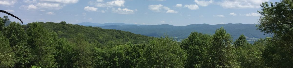
Midway through the day we stopped at the Laurel Creek Shelter to eat lunch and refill our water. One unusual feature of the afternoon hike was passing through pasture land for about two miles. I was grateful to the landowner for allowing the trail to pass over his property, but more thankful that he had mowed a 5’ strip on either side of the trail so that we weren’t walking in waist high grass. It was a beautiful area and we could see for miles all around. Near the end of the farmland was a swampy section where about 100’ of split log “bridge” had been laid. These little details of trail maintenance never cease to impress me.

One of the notable trail features that we passed on Monday is the Keffer Oak. This is the largest oak tree on the southern part of the AT, boasting a circumference of nearly 19.6 feet. It is 60’ tall and has monstrous limbs. From there, we began our second climb of the day onward to Sarver Hollow Shelter.

The shelter area was busier than usual. Iron Man came in after us, as did several other hikers that we knew and some that we didn’t. Most folks tented, but once again I braved the mosquitoes and opted for the convenience of the shelter. There was a large grassy area out in front and there was also a comfortable bench to sit and read in. One of the nice bonuses of this shelter was a tree right out front from which to hang our food for the night. Sometimes we have to search for 5-10 minutes in the woods around the shelter, so when you find one so quickly and close by, it is a major accomplishment.

I have to say that I’m very pleased with our daily mileage for the week. Three 12+ days and a 16.1 trip to Pickle Branch Shelter today is our best four-day combined total yet. The early part of the day was a nice ridge walk followed by a downhill section. We made great time on this part of the trail. Then the hammer dropped. We had a 1,500’ climb that stretched over three miles. The first part of it wasn’t too bad, but near the end, it felt like we would never stop going uphill. At the top, we were rewarded by the Audie Murphy memorial. Murphy is the most decorated American soldier of WWII. He was killed in a plane crash just off the AT in 1971 and the VFW Post 5311 constructed a memorial near the crash site in his honor. There is a large marble tablet and a flagpole. Around the monument is a stack of rocks that hikers have placed there in remembrance, as well as flags, dog tags, medallions, and other military-themed memorabilia. I must admit that I felt as if I were standing on hallowed ground.

Just before the long climb up to the memorial, I realized that Gavin didn’t have much water, so I sent him a few tenths back to the stream to fill his bottles. I felt like I hiked especially strongly on Wednesday, and when I reached the monument, I expected him to be 30-40 minutes behind. I had no more than taken my pack off and sat down on a bench to say a prayer of thanks and remembrance to those who lost their lives in WWII when up pops Gavin. He was no more than 5-10 minutes behind me. This is a testament to his hiking ability- I continue to be amazed at what a strong hiker he has become in the past three months. All the hikers we have met have been complimentary of his speed and endurance. I believe that he is fully capable of keeping up with the many twenty-somethings that we have met on the trail, and that is a terrific compliment.

We were thankful that the last five miles to the shelter were mostly downhill. Unfortunately, the shelter was 0.3 miles off the trail, but it was nowhere near as difficult a trip as was the 0.4 downhill trip to the Sarver Hollow shelter the night before. The water source for the shelter was a nice stream, but it was an additional 0.2 miles, downhill. I really like it best when shelters are on trail and the water is very close by. Unfortunately, these are few and far between.

To reward ourselves for the past four longer days, we only planned to hike 6.7 miles on Thursday. Four Pines Hostel was just a bit off the trail at a road crossing, and there was a gas station with food and resupply items a few tenths of a mile down the road in the other direction. One highlight of Thursday’s hike was crossing the 700-mile mark. Three times. For whatever reason, there three places on the trail that were marked as 700-mile point. I checked the last one in the Guthooks app which reported my location as 700.5. The day’s hike also included the first landmark of the Virginia Triple Crown: Dragon’s Tooth. We had a 1,500’ climb to get there, but it was a marvelous sight. Dragon’s Tooth is a large rock spire that sticks out of the ground on a ridge. It can be climbed, but I would consider it perilous, and if you fell off the wrong side, it would take you a long time to hit the ground on the other side. I opted to just take a few videos and leave it at that.

The fun part of the day was descending the ridge line from Dragon’s Tooth. It was the most difficult, technical mile of our entire trip so far. The trip down included several places where steel “handles” had been cemented into the rock because there was nowhere to step or grab. It also included some other places where there should have been steel helpers. One particular part was on an 8-10’ nearly vertical rock face with only a 2-3” crack to walk along as you zig-zag your way down. Even after the steeper, more vertical descents, we still had to contend with rock-hopping for nearly a mile. When we finally reached the bottom, we saw a sign for the south bound day hikers who would have to ascend this treacherous trail: “Caution: The next mile of trail is rocky and steep in sections. Please use caution and follow white blazes carefully.” I cannot repeat here what I thought when I saw that sign, but the common phrase invoked the name Sherlock.

Finally, we reached the road crossing at trail mile 704. We had to make a choice: go on to the hostel to the right, or go get food and drinks to the left. The distance was about the same either way. We opted for the food and Gatorade option. The gas station has hot dogs, hamburgers, and pizza so we decided to have lunch. While we were sitting outside at a table, the owner of Four Pines Hostel drove up to get his lunch. He offered to drive us back when he finished eating. I cannot remember a time when I have been more grateful to have a ride somewhere!

Four Pines is a hostel in a 3-car garage. Half of the space is set up as a common area, with couches and tables and chairs. The other side houses 14-16 bunks for sleepy hikers. Outside there were chickens and guineas running around everywhere, along with a few cats and dogs. Though we were “warned” that it might not be the most family friendly hostel on the trail, we found it to be quite pleasant. Before the afternoon was up, the place was full of hikers, and several folks slept on the couches or in tents outside. Though there was only one bathroom/shower and no towels, it was still quite nice to get cleaned up. There was also a washing machine, which my clothing severely needed, and a clothes line out back.

Perhaps the best part of staying at Four Pines is that they shuttle you to dinner at the Homeplace Restaurant nearby. They serve southern comfort food family style. You get chicken and your choice of two or three other meats, and delicious vegetables. I ate my fill of roast beef, pulled pork, green beans, mashed potatoes, baked apples, pinto beans and the best coleslaw I’ve ever tasted. To top it off, they had blueberry cobbler, a la mode. They just kept bringing more bowls and plates of food. It was the best food experience on the trip yet!

I slept fitfully at Four Pines, and apparently I snored a bit. At some point in the night, the hiker in the bunk beside me poked me with a trekking pole and said, “Could you roll over or something?” I apologized to her the next morning for waking her up. She accepted, but I’m not sure she forgave me.

Friday was a day of decisions. Several folks were planning to slackpack on into Daleville, a distance of 26.2 miles. I considered this crazy, since our best day was just shy of 18 miles, but we were hoping to get on into town as early Saturday morning as possible to see Beth, Griffin, Joy, and Sallie and her crowd. I looked over both my trail guides for a place we could hike to in between the hostel and town where Beth could pick up our packs Saturday morning and allow us to slackpack on in, but there was not a convenient road crossing. Finally, we settled on hiking to Lamberts Meadow Shelter, 16.4 miles upward, which would leave us only 9.4 miles into town on Saturday morning. This trip included the other two points of the VA Triple Crown, McAfee Knob and Tinker Cliffs.

We set out with full bags of water because there was to be little available on the trail in this section. McAfee knob is probably the most photographed viewpoint on the AT, and it was 9.6 miles ahead of us. The climb up was actually not difficult. I believe the trail is intentionally graded for day hikers, because there were tons of those. I’m quite sure that if we had reached the top earlier in the day it would have been swarming with people. The views from the ledge atop McAfee Knob were stunning. There is a section of rock that overhangs the valley below where one can take a “Lion King” photo. Even though it looks like you’re thousands of feet up off the valley floor, the rock ledge is only 40-50’ off the ground below. That is still quite a long ways to fall, but surviving the fall might be possible if you landed properly in the trees underneath. If it were as high as it looks, though, at least you’d have time to say a lengthy prayer before hitting the ground below.

With McAfee Knob checked off the list, it was onward to Pig Farm campsite to fill our water bottles before continuing onward to Tinker Cliffs. I was pleasantly surprised by this trail feature. When I see the word “cliff,” I think of treacherous terrain and long falls. I was pleased to find that even though there are steep cliffs, you don’t have to walk right along the edge. As we were going along this section of trail we observed several turkey buzzards drifting around effortlessly in the sky. It was majestic to behold.

With the last of the Triple Crown behind us, the only thing left to do was get on down to Lamberts Meadow Shelter, eat and sleep, and get up and head on into town to see the family. Along the way, Gavin got this crazy idea: “Why don’t we go on into town tonight?” The rational part of my brain told me this was an absolutely insane proposition because, including the road walk from the hostel to the trail head, it would make for a full marathon: 26.2 miles. Along the way, we talked about it, and I was trying to figure our best pace and what time it would be when we got there. When we arrived at the shelter, we sat down, took stock of how battered our bodies were feeling, and filled our water. Looking at the terrain, it should be an easy walk, and we should be able to average 3+ miles/hr. That meant it wouldn’t be midnight when we got there, more like 9:30-10:00. Against my better judgement, we decided to go ahead with the trip.

We were able to make the pace we thought for most of the trip, but about five miles out, the trail turned rocky. And dark. We donned our headlamps and paced onward. Finally, we reached a section of the trail with so many sharp rocks and small climbs that I questioned our decision. We got through it, but it wasn’t pleasant. We also ran out of water about two miles from town, and I think we were both about to run out of gas for walking. We had hoped to surprise everyone when we got to the road by calling and having them come pick us up, but about halfway along Beth called and she didn’t understand why were still hiking at 9:00 at night so we told.

When we got near to the roadway, Gavin called again to muster the minivan. While he was on the phone, he got a bit ahead of me and he came to a trail junction. One way was to the “park and walk” area, and the other continued down the trail to the road. When I got to the sign, I had no idea which way he went. I took what looked like the correct trail, but after a few hundred yards of not seeing a blaze, I turned back to have another look at the crossing. Still no Gavin, but the other direction had blazes so I continued onward, hoping he was in front of me. Finally I reached the road, still without sight of Gavin or any of our transportation. I got a bit panicky and called him on the phone to ask where on earth he was. It turns out that he took the path I had started down which went a short distance to a parking lot. It was a tenth or two miles down the roadway where I came out. I finally managed to figure out where everyone was and I parked myself in a gas station parking lot to await a ride. Not long after, I heard Sallie calling out so I walked to meet her.

It turns out that when Gavin got to the car and I didn’t, Beth took his headlamp and headed up the trail he came in on to look for me. Without her phone. By this point in the day (night) I was tired and furious. I jumped on him pretty hard for leaving me behind after I had asked him earlier in the evening to stay close in the dark. I know I hurt his feelings, and that he only walked ahead because he was excited, so I apologized a bit later. I think he understood my frustration. Meanwhile, Sallie took my light and went back up into the woods to find Beth. Eventually we all got together in one place and we headed back to the hotel. I honestly don’t know where I summoned the energy to walk up the stairs one flight to our room. I am only thankful that our room was right at the top of the stairs rather than all the way down the hallway.

Once in the room, it didn’t take me long to get into a hot shower and clean clothing. Needless to say, I slept like a baby Friday night. I almost didn’t make it up to get the breakfast that was included in the price of our stay. I am thankful that I did, because real coffee tasted so good, and it has been quite a while since I have had it.

Most of the day has been spent in the hotel room catching up on the blog. We did take some time out this morning to visit the local outfitter. It was quite an expensive trip. Gavin and I both needed new shoes. I also had to buy a new pack because I’ve lost so much weight that the one I started the trail with didn’t fit properly any more. For a price, they were also able to solve the “sweating in a 25° bag” problem with a 40° quilt that weighs only a pound. Even though it was a pricey trip, I’m pleased with my purchases and am excited to try them out. But not too excited. I’m going to sleep indoors for two more nights, and with this blog entry completed, I mostly have the day off tomorrow except for a resupply run that I hope will be brief and what I hope will be a quick trip to a laundromat.

It was truly fantastic having some time to spend with our family. We are also hopeful that we’ll be rejoining our trail family soon, as we head out from Daleville or just beyond. We appreciate you for following our progress and encourage you to keep sending us comments. Finally, always remember to just keep taking the Next Step.

AT Days 78-84

On Sunday, May 12, we left the relative comfort of a hotel to head back into the woods. We had talked to a local shuttle driver, Bubba, whose significant other worked at the hotel, about possibly driving us back to the trail at the Brushy Mountain Outpost and taking our packs onward to Trent’s Grocery so we could slackpack. His fee was moderate and we struck a deal. Looking at the guidebook, it was to be an easy day of hiking and we were able to cover 18.4 miles.

I should have learned by now to always look at the guidebook more carefully so I am not surprised by the features of the trail. Today’s surprise was a lengthy suspension bridge over Kimberling Creek, just before the road crossing that leads to Trent’s Grocery. When we reached the road crossing, I was mildly panicked because Gavin wasn’t there. I saw the trail go on up into the woods on the other side and I was afraid that he had continued up the trail. Thankfully, we both had cell signal so I was able to call him. He said that I should go to the left at the crossing and that he was already in sight of the store, about 0.5 miles down the road. This is a testament to his prowess of navigating the trail and the outright speed at which he as become accustomed to traveling.

Trent’s Grocery was a great trail spot to stop. Essentially, it is an old fashioned country gas/grocery/grill. I believe they have a couple of indoor rooms for rent, but they also allow tenting in a field behind the store. They have a bathhouse and laundry facilities as well. The only downside was, they don’t provide towels, and as a general rule, those are luxury items not carried by many hikers. They do have great food. Gavin had a cheese pizza, which was one of the best we’ve had, and I had a cheeseburger and hotdogs that really hit the spot.

There were several other hikers we’d met before that were tenting at Trent’s. Among them were Gravy Train and Pringles. There was a campfire and we enjoyed standing around and shooting the breeze that evening. One of the things I have enjoyed most about this trip is interacting with other hikers.

The other notable thing about staying at Trent’s was the rain. It started just about the time we got to the field. Quickly, I laid out the footprint for my tent, put the poles in the corners, and threw the rain fly over and staked it all down. In the processes, the footprint got rained on a bit, so I decided to wait until later in the evening to put up the tent body from the inside. Eventually, later on came, and I decided to not bother with putting the tent up inside. Using only the footprint and fly is a way some people save weight when hiking. It is a good plan, but I expect that as summer comes on, I’ll want the tent body to protect me from the bugs.

Monday’s walk was one of the flattest on the trail. Not far down the trail we began to parallel Dismal Creek for several miles. One of the views on the trip today was Dismal Falls, but it was 0.3 miles off the AT so we opted not to take the blue blaze trail. I was confident that we we would see other, more impressive waterfalls on up the trail. It was very peaceful to walk along Dismal Creek for as long as we did. We crossed over it multiple times, and of course, it was great to not have to load our packs heavy with water.

After our really long hike on Sunday, we all agreed that doing a shorter day today was in everyone’s best interest. It was. It was nice to arrive at the shelter in the early afternoon and have the opportunity to rest and relax. Even though we are at a point where we are hoping to ramp up our mileage, if you average the two days together it comes out at 13.2, which is significantly more than we’ve been walking.

We also scored our largest animal sighting to date: three deer off in the distance from our campsite. Bullfrog was walking out the trail to the water source when he saw them. By the time he came back to the shelter to tell the rest of us, they were wise and ready to bolt. I followed him down the trail with my camera on, but most of the footage I got was of the back of Bullfrog’s head and only a few glimpses of their behinds as they ran away.

We slept really well at Wapiti shelter, even though there was a rumor that it was haunted. In 1981, a man from Pearisburg, Randall Smith, befriended two hikers at the shelter. That night while they slept, he shot one, and stabbed the other. Both succumbed from their injuries. He was imprisoned for 15 years, after which time he went back in the woods nearby and tried to kill two fishermen. They both survived the encounter but Smith died from injuries sustained in a car accident while trying to get away. Needless to say, I didn’t relate this story to Hawkeye. I believe the reason we slept so well was that the temperature dropped to the low 40’s. Being in possession of a 25° sleeping bag, I always sleep better when I’m not sweating and sticking to the nylon interior of the bag.

Our hiking day consisted of a nearly 1,300’ climb to get on a ridge line. Once there, we pretty much stayed at the same elevation, with small drops and climbs, until we descended to Doc’s Knob Shelter. One of the great things about walking the ridge line has been the near constant breeze, which is especially refreshing when you’re hiking in warmer temperatures. The downside is, in our experience, ridge walking involves lots of going over and around rocks. It is difficult to describe the difference between good rocks and bad ones. The good ones are reasonably large with flat surface enough that you can put your whole foot down on them. The evil, nasty rocks are the ones that line the trail and stick up with sharp edges and corners. They are often so close together that there is no good place to plant your step, so you just have to endure the jaggedness on the bottom of your foot. Also, rocks that you have to stop and figure out a way to climb up and over are particularly unnerving. Additionally, there are some that are close and tall, so you have to place your foot between the rocks and hope you don’t fall over while your foot and leg are pinned in. This is a great way to get a tib-fib fracture, and I must say that I am definitely not a fan.

Doc’s Knob Shelter was among the nicest that we have stayed in. It was just off the trail, among rocks, go figure, but there was an incredible deck in the front. The deck featured built-in seating with backrests and was much more comfortable than sitting on a picnic table. There were also two tables to cook and eat on, and there was a double Adirondack chair. Additionally, the deck was connected just at the front edge of the shelter so we didn’t have to climb up (or down in the middle of the night) to get to the sleeping platform. Best of all, the temperature was down in the low-40’s, so I slept very well.

When we awoke, we set out for the small town of Pearisburg, VA, 8.3 miles down the trail. By 8:00, we had said our daily prayer and were on trail together with Angel and Bullfrog. Like the day before, the majority of the hike was on a ridge line with small, undulating ups and downs, until we began descending into town about 2.5 miles from the end of the hike. Gavin quickly took off out front, and I was next. The hike was an easy one and he and I arrived at the road crossing well before noon. Angel and Bullfrog took their time and were about 45 minutes behind.

Once regrouped, we began discussing the matter of how we were going to get into town. One option was to road walk about 0.5 miles to a hotel. Angel offered in that she has a Facebook acquaintance that has been following her hike who had volunteered to shuttle us around in town. While we were discussing whether or not to text him, he pulled up at the trailhead. Providence. His name is Justin and he loaded us all into his car and drove us to the Holiday Motor Lodge. I must say that we were forewarned by comments about this hotel on the Guthooks App, but this is the place we chose because it was the only one that boasted WiFi.

We got checked in, showered quickly, and Justin drove us to Blacksburg, VA to have Mexican for lunch. It was great! The only bad part about lunch was that I left my favorite hat and didn’t realize it until hours later. We also visited an outfitter where Bullfrog got new shoes, and I got Gavin a new knife. We also popped into Barnes and Noble so Gavin could get a book. It was really neat driving around in Blacksburg because it is a university town. All along the street were 6-foot tall fiberglass Hokie mascots. I texted a photo of one to my friends Brian and Melody who are both alums, and Brian texted back, “You’re in God’s country. You’ve now reached the highlight of the entire trip!” I’m not sure I completely agree, but the food was great and the trip down and back was quite scenic.

Once back at the hotel, we began settling in. I logged into something posing as WiFi with the hope of uploading some videos. Unfortunately, whatever it was that accepted my password only occasionally loaded a web page. Watching a YouTube video or uploading one was completely out of the question. I also began to notice small features of the room that one rarely finds in a hotel. First, there were quite a few chunks of plaster missing from the ceiling, and you could see where nearly ½” of drywall mud had been placed there to patch a previously wet ceiling. Then there was the matter of the dish of “air freshener” on top of the TV cabinet. It had a sickeningly sweet smell that made me wonder what odor it was there to cover up. The pink tile bathroom with blue floor tiles was a nice touch as well. I realized, only after visiting the Food Lion across the street and getting drinks, that the fridge in the room wasn’t working. The coup de gras, however, was the sign on the ice machine which read, “As per state laws of the Commonwealth of Virginia Dept. of Health, ice produced in this type of machine is strictly for external use only.” That, and the fact that most of the folks staying in this “hotel” were permanent residents, caused me to want to get out as quickly as possible.

We had an “out” plan. Just behind the Food Lion was a small trail that lead 0.2 miles to Angel’s Rest Hostel. We had originally passed this by as an option because we weren’t sure that they allowed adult beverages. Further reading about the place, though, revealed that as long as you don’t get stupid, they’re pretty much good with whatever, except for drugs, and we were good with that. Needless to say, Gavin and I awoke extra early, packed our things, and headed down to the office prepared to have to battle to get our money back for the second night we weren’t staying. Thankfully, there was hardly a discussion, except the clerk asked if there was something wrong with the room. Being the tactful person I am (sometimes), I just explained that the fridge didn’t work and I really needed strong WiFi so I could upload to YouTube. With money put back on my card, Gavin and I hiked over to Angel’s Rest and were able to get a private room for the same cost as the hotel we’d just left.

Angel’s Rest Hostel is without question the best hostel I’ve stayed at along the trail. We were checked in by Nickel, whom we’d met back in the Smokies, and he remembered us. We also met up with some other hikers that we hadn’t seen in a while. One lady we’d met back at The Station at 19E, Not Dead Yet, was there doing work-for-stay while in the process of healing an injury. Our room was the master bedroom of a mobile home. We had free access to the kitchen, the den had a TV with Hulu and DVDs, and we had our own “private” bath, shared with whomever stayed in the other bedroom. Outside there was a bunk house and the nicest shower/bathroom area I’ve encountered. The bathhouse consisted of three individual rooms, each with a shower, sink, and toilet, that were cleaned and cloroxed daily. Best of all, there was WiFi strong enough for me to upload videos to YouTube.

In the afternoon, we went back up to Motel Hell to see Angel and Bullfrog. Her friend Justin was coming to drive us all to dinner with his family in Radford. We went to a tap room called Sharky’s, and it was awesome! Gavin was able to get his new favorite, buffalo wings with blue cheese dressing, and I had a full rack of ribs with a salad and fries. It is difficult to overstate how wonderful it is to get into a real restaurant after eating Knorr pasta sides and spam for dinner for several days in a row.

Originally we had planned to get up on Friday morning and head back to the trail, but Angel and Bullfrog had other plans. She was getting a ride back to Trail Days in Damascus from her friend, and Bullfrog’s uncle was planning to join him on the trail for a few days. The fact that we were separating briefly as a trail family and the rainy weather made it pretty easy to decide to stay for a second night at Angel’s Rest. I had intended to get up and go to the motel to see Angel off, but between the rainy weather and the fact that I was still in bed, I sent her a text message wishing her a good trip instead.

After Angel left, Bullfrog came down to Angel’s Rest to wait on his uncle Ken and his family, who arrived in the late afternoon. We all went together to dinner at a local comfort food restaurant. It was enjoyable to meet and talk with Ken. He had started the AT with Bullfrog, but health issues caused him to get off trail fairly quickly. After seeing his physician and exercising regularly for a couple of months, he was ready to give it another go. I was excited to have someone new to hike with, but we all knew that after a few months on the trail, we’d be walking faster than he’d be able to, so we weren’t sure how long we would be together.

On Saturday, Bullfrog and Ken hit the trail about 8:00, heading for Rice Field Shelter 7.8 miles up the trail. Gavin and I got up and moving slowly, as is usual when leaving town, and didn’t get going until 11:00 or so. Even though the distance to the shelter was fairly short, the bulk of the day was spent climbing almost 1,800’ back to the ridge line. I had a terrifically difficult day of hiking. It seems that I was stopping to breathe and rest every 50 yards or so. It was worse than the early days of our hike when I had no trail legs at all. Gavin, who, according to him, “doesn’t do” uphills, was soon well out in front of me. On the way up, I passed Bullfrog and Ken, who were resting on the side of the trail. I slogged along, slowly, and finally reached the water source, about 0.6 miles shy of the shelter. I stopped to fill my water bladder and was in the process of standing up, folding the top of the bag over, and sliding the clip on, when, the next thing I knew, I was on my butt in the mud. I suppose that I had become so dehydrated that I passed out. Thankfully, when I fell, I missed all the rocks that were in the spring with my head and came out of the event with only a small scratch and bruise. Not long after, several other hikers, including Bullfrog and Ken came along and made sure I was nursed back to health. Bullfrog mixed up an electrolyte solution with Orange Crush drops and I began the process of rehydrating. After a few minutes, I felt fine, and I hiked on to the shelter without incident.

Rice Field Shelter sits atop a ridge just in the treeline of a large, open field. We had excellent views of the town and houses below, and the sunset from the ridge was outstanding. Snow Cream was also at the shelter, and it was good to reconnect with him. We all had enjoyable conversation and rested well.

It was difficult to be without Angel today, but we know that she’s having a good time at Trail Days in Damascus, and that we’ll catch back up with her later on. One thing I’ve learned from the trail that is a good lesson for “real life” is that friends are important and should be treasured. Thanks for joining us for this installment of our travelogue, and remember to just keep taking the Next Step.

AT Days 72-77

Before I start my “weekly” update, I want to mention a few things. First, my YouTube channel is marvelously out of date. The past couple of places we’ve stayed have not had good outgoing WiFi, so uploading videos has been a challenge. I was able to get one out last night, and I’m about 55% uploaded on another. I was really hoping to get several more uploaded today, but it may not happen. Second, the little photos that are in the margins are “clickable” if you’d like to see a larger version. I have tried to include pictures that represent the stories I’m telling, but at some point I’ll create some albums here on the blog. Now for the week’s story…

Monday was a short day. We lazed around the hotel and got a shuttle back to the Mt. Rogers Visitor’s Center. We only had a 6.8 mile hike to get to the Chatfield Memorial Shelter. The trail was extremely rocky in this section. Not little gravel, but rip-rap sized rocks with lists of sharp edges and corners. It made putting your feet flat on the trail nearly impossible. By the end of our trek, I was punchy and sarcastic about the terrain. I was so looking forward to writing my longest entry in the shelter log; I kept going over it in my head along the journey. Unfortunately, the shelter log was completely full so I didn’t get to express myself. Allow me to do so now:

Dear Appalachian Trail Conservancy,

I have most thoroughly enjoyed hiking the section between the Mt. Rogers Visitor’s Center to the Chatfield shelter. I look forward to coming back and rehiring this section when it is completed. I must have traveled over at least 150-200 feet of trail today that had not had the sharp, pointy rocks installed. Hopefully the trail maintainers can get on this quickly. Also, some of the rocks that have already been put in place have ad their edges and sharp, jagged corners worn off due to heavy travel. When you come back out again, please have a look a these and replace them with fresh rocks.

Sincerely,

Waffle

Needless to say, I am greatly disappointed not to have been able to share my sarcastic thoughts with others on the trail who had just hiked the same stony path.

There were two other remarkable things that happened on Monday. First, Snow Cream told us that he would be parting ways with us. I think he was at a point where he needed some alone time, and he also wanted to hike longer miles than we are currently able to do. It was sad to know he was leaving our trail family, but I’m sure we will see him up the trail somewhere. Second, this was the first day that we’ve passed multiple rhododendrons that were in bloom. They were gorgeous. I hope that in the coming weeks we’ll pass through large areas of blooming trees, as they add so much beauty to the trail. I believe one of my first projects when I get home will be cleaning up the creek bank behind the house and planting some rhododendron. I’ll have to look into rooting them from the bushes behind mom’s house.

Tuesday had several big events in store. The shelter where we stayed was only about two miles from the historic Lindamood School, a one-room schoolhouse from 1894. Perpetual Trail Magic is provided by West End UMC of Wytheville. They leave cold drinks, chips, health and beauty aids, and pretty much everything else a hiker needs. I’m disappointed that we arrived too early in the day to visit the Settlers Museum, but it isn’t too far away from home to go back one day. The second treat of the day was passing by The Barn restaurant just before we crossed under  I-81.I was really hoping for a steak, but they were still serving lunch when we arrived. No matter. They had a hamburger steak and potatoes. It was awesome! I think easy access to whatever food I want to eat is one of the things I miss most about being in the woods. On the other hand, I wouldn’t trade anything for the things I’ve seen, the experiences I’ve had, and the people I’ve met while I’ve been on the trail.

Today’s hike included some out of the ordinary hiking conditions. For one thing, we crossed over a railroad bed. We were sure to stop, look, and listen before crossing. Almost immediately after, we went through a boggy area across a boardwalk. I appreciate that it was nearly 3’ wide, because sometimes I tend to drift off to one side or the other. Finally, we hiked quite a ways through pastureland. Though we’ve done that a few times before, it has only been recently. We were blessed that it is still spring, so we weren’t in the hot baking sun. I think that treat is reserved for northern Virginia and beyond.

We camped at the Crawfish Trail campsite, just a few hundred feet short of the ¼ way mark on the AT. It is hard to believe that we’ve come this far. It is also daunting as well, because we hope to finish our hike before mid-August. If we’re going to do that, we really need to be hiking longer days. I have been trying to remember to do some calculation to see what our daily mileage average should be, but I’m almost afraid to do so. It was a treat to be back in my tent for a night. I suppose I could be setting it up at shelters when we arrive, but it is just easier to throw out my bedding and crash on the shelter platform.

On Wednesday morning we got out of the campsite a little late, but we did eventually get going. We had set our sights on the Chestnut Knob Shelter, some 17.4 miles away. By late in the day, we realized that even though the climbs on the trail didn’t look like much on the map, they really took the wind out of our sails, so we settled for a shorter trip to Lick Creek. Even though the AT Guide doesn’t show a campsite, there is plenty of room for several tents there, so we pitched right beside the creek.

The creek is, in my opinion, a bit large to be called a creek. It was wide enough to require a well-constructed footbridge to cross, and it was deep enough that one could jump in and cool off. Or cold off. I waded into about ankle depth and remembered hearing stories of middle-aged men who have had heart attacks from submerging suddenly in cold water. Having already had one of those, I decided not to chance it. I did, however, get my bandana wet and washed off some of the hiker funk. I’m not sure it did much good, though. Angel and Bullfrog, being younger and less susceptible to sudden coronary issues, did brave the cold and talked about how refreshing it was. Gavin just hung out along the bank and searched for crawdads.

The only two bad things I can say about the campsite are, (1) the mosquitos were out in swarms, and (2) there were precious few places to hang our food for the night. I looked for 15-20 minutes and had to eventually “settle” on a tree nearby the creek. I wasn’t completely confident about the bear hang, but I chanced it. I was hopeful that all the neighborhood bears had found out about the buffet at Hurricane Shelter several miles south and had gone down to join in.

It rained a little bit Wednesday afternoon, but fortunately we had already set up our tents and such. It was kind of peaceful laying inside listening to the creek noises and hearing the raindrops on the fly of my tent. I’m really glad that the rain stopped after a short time and we didn’t have to break camp in a storm. I am pretty sure that some folks came in and camped across the creek after we had retreated to our respective tents, but they were either farther back in the woods that I had imagined, or I imagined the whole thing, because there was no sign of them the next morning.

One highlight from Tuesday that I must mention is Gavin’s reintroduction to Pringles, a lady hiker from western NC. We were on a shuttle in Hiawaswsee together months ago, but I had forgotten her. We passed her fairly early in the day while hiking the uphill section through a cow pasture. Gav was a bit behind Bullfrog, Angel, and me, and he started up a chat with her. It turns out that she listens to the same D & D podcast that he likes, so they hiked together and takes for several miles. When we stopped at Knot Maul Shelter for lunch, I really thought she looked familiar and finally it hit me: she was in some of Amanda Bess’s trail videos from last year. Pringles shuttled Amanda Bess around in Hot Springs, NC, and now she has her own YouTube channel to document her hike.

Our Wednesday plans of hiking a long day aborted, we regrouped and decided to make Thursday a long one. According to the guide, it was 16.4 miles to the Jenkins Knob shelter, and it would be extremely easy-going after a 2,500’ climb in the first five miles. In fact, the last six miles of the trip are the flattest looking of any I have seen on the AT Guide’s elevation profile. What we didn’t account for, though, was rocks. Lots of rocks. Big ones, little ones, sharp ones, and pointy ones. The trail went up and down 30-50’ at the time (fairly flat), but always on rocks. Aaugh! This was our longest day of hiking and by far the least comfortable on the feet. The rocky trail from a few days ago had nothing on this section of the trail.

The other trail highlight from the day was the many stiles we had to cross over fence lines. I really prefer cattle gates because they don’t involve the rest of falling or breaking your leg. Essentially, a stile is an A-frame “ladder” that is set up over the fence. In theory, there are handholds secure enough to stray a topheavy hiker, but in practice, it is still a dicey crossing. There was one in particular that stood about 8’ tall that really made me nervous, but we all made it up and over safely.

Jenkins Knob shelter was a fairly busy place Wednesday. We ran back into Snow Cream, though we’re still not hiking together. Pringles was tenting there, as was Blue from Mass. I did have one new experience. Someone had left a horseshoe at the shelter which I used as a weight to throw my bear line into a tree. Eventually. To hang the line, you tie something heavy, usually a bag of rocks, to the end of the rope and throw it up and over the target tree limb. I am pleased to report that the rock bag works much better than a horseshoe, and if it gets stuck on some small limbs, the rock bag is much less deadly when you’re pulling hard on the rope trying to free it from its obstruction.  It is difficult to believe that in a forest there would be few trees with suitable limbs for hanging food, but that was the case again on Wednesday. After finally finding an “okay” tree limb and getting the horseshoe up and over, my food was hanging a little low and close to the tree, so I tied the tag end of the line out to a second tree to pull the bag up and farther from the trunk. I am not a fan of using this method because some bears have learned that ropes tied to trees are often connected to food. Fortunately, the bears in our area have not been so informed, so my food was still there the next morning.

As our feet were being tortured on Thursday I had time to think about Friday’s hike. I also had cell service so I checked the weather ahead of us on the trail. The forecast was for rain on Thursday night (it didn’t), showers Friday, and rain on Saturday. We had been shooting for Trent’s Grocery, about two days out. I noticed in the guide that we’d be passing by a road crossing to Bland, VA on Friday. What if we did our 11.3 miles to Bland, took a zero day to heal our rock battered feet on Saturday, and slackpacked to Trent’s Grocery on Sunday? I pitched it to the group and we were all in agreement that a day off would be much appreciated, so that is what we did.

The hike Friday was fairly easy, even with a few uphills. One notable trail feature from Friday was all the switchbacks that made our largest climb quite manageable. It was definitely the longest trail section for a short climb we’ve experienced. In most places, we hardly felt like we were going uphill at all, the grade was so gentle. I really hope the “overkill on switchbacks” trend continues.

We ended our hike at the Brushy Mountain Outpost, a deli/resupply store right on the trail. Since we had not arranged a shuttle to get us to the hotel, we decided to go ahead and have lunch while we sorted that out. I had a cheeseburger with chili, slaw, onions, and mustard that was out of this world. It was definitely the best cheeseburger I’ve had on the trail so far. Not quite Crossroads Grill back home, but close. Snow Cream was also at the Outpost and he had arranged to get picked up by a nearby hostel. The driver was willing to take the rest of us with him since he had to drive past the hotel anyway. We arrived at the hotel around 2:30 and set about the task of relaxing.

The Big Walker motel is right on I-77 just outside of Bland, VA. Across the street is a Circle-K/Dairy Queen truck stop that I’m pretty sure we’ve stopped at before for gas and snacks when traveling to Pittsburgh. There is also a Subway and Dollar General about 0.5 mile down the road. Everything a hiker needs.

Saturday morning I went down to the motel office around 8:00 to get coffee. News was stirring that there had been some sort of disturbance on the trail overnight. This was not the first disturbing news we’ve heard while on the trail. When we were a few days north of Hot Springs, NC, stories broke about a hiker on the trail who had reportedly assaulted some hikers with a large knife. He was arrested a day or two later, charged with minor crimes, plead guilty, and was released. Though details are still unfolding, apparently he got back on trail and stabbed at least two hikers near the Knot Maul shelter, only a couple of days back from where we are now. We have heard that one of the two died as the result of the injuries. The perpetrator is in custody and a 16-mile section of the trail north of Marion, VA is currently closed while the investigation continues. We are prayerful for the hikers who were attacked and that all of the rest of us can hike safely on to Katahdin.

It has been a very restful day here at the hotel. We’ve hit the DQ, Subway, and Dollar General to satiate our food needs. We did laundry in the tub and in the sink and hung our clothing out under the gazebo to dry, even though it has been rainy most of the day. Other than that, I have been writing and waiting for another video to upload to YouTube. Angel and Bullfrog are eager for my videos to catch up to the point where we all met. WiFi willing, that should happen fairly soon. We have arranged for a shuttle to take us back to The Outpost and our packs to Trent’s Grocery tomorrow morning. We are all hoping that whatever rain is left in the area will pass over tonight.

And that’s the way it was… I will again thank you for following along on our journey. I will also ask you to continue your prayers for us and other hikers. Even in light of the news from the trail today, the AT is much, much safer than day-to-day life in “civilization.” Thanks again, and remember to just keep taking the Next Step.

AT Days 64-71

The morning of day 63 found us rising early in the Abingdon Gap Shelter. Bullfrog wanted to get into Damascus early to be assured of finding a barber, so he an Angel left out about 7:00 AM heading for town. Snow Cream left a little while later, around 7:30. Gavin and I are the slowest to get out, but we were on trail by 8:08 AM. The trip in would be 10.4 miles. I looked at my watch and at the terrain and I told Gavin that this would be a great chance for us to make 10 by 12. That is trail lingo for getting ten miles in by noon. Generally, this indicates a great start to a long day of hiking, but the ten is all we needed to make it into town to a hostel. I am pleased to report that at just a few minutes before noon Gavin and I walked under the archway on our way through the town park in Damascus.

A few days earlier we had made reservations for us to stay at Woodchuck Hostel, a place Gavin and I had stayed before on a family trip. We didn’t realize that Woodchuck had sold the business, but it was a nice place to stay nonetheless. I will say that now, under new ownership, the place has a far more feminine touch. The front room of the house used to be filled with antiques and AT memorabilia. Now it has six twin beds with matching bedspreads and pillow shams. The second room back used to be a dining room. I remember the corner cabinet, filled with every variety of cereal imaginable. Now it has four twin beds, also with matching spreads and shams. The other front room must be an office now for whomever is watching over the place. It used to have beds and a stairway to the upstairs, another sleeping area, but it is now marked “Off Limits.” The only thing that hasn’t changed much is the kitchen, but for whatever reason, hikers no longer have kitchen privileges. That really threw a wrench into the works when it came to me cooking supper for the group. Oh well, the vegetable soup will have to wait for another day.

Instead of a home-cooked meal, we got the lady who is watching over the hostel to take us into Abingdon for an AYCE Chinese buffet. AYCE is also trail lingo, and one of the most important terms. It stands for All You Can Eat. At this stage of the hiking game, hikers can eat for lengthy periods of time without guilt. We are likely burning in excess of 5,000 calories a day, and it is quite difficult to carry enough food to satiate the hunger. For that reason, hikers almost always make a hard turn off the trail when they see AYCE. On the way back we had to go through Bristol for Angel to have some cell phone maintenance. Apparently, the rain we passed through on Friday did hers in. When we got back to the hostel, we walked a block or two into town and visited Adventure Damascus, Mt. Rogers Outfitters, and the local Dollar General. Afterward, we came back to the hostel and settled in for the evening.

What an evening it was. The five of us and one other hiker we had met previously occupied the six beds in the front of the house. Lucky for her, Angel fell asleep fairly quickly. Then Snow Cream started snoring. Then Gettin’ There started snoring even louder. Bullfrog chimed into the chorus as well, and I had a most difficult time getting to sleep. I’m sure that once I did, I did my part to raise the roof. I am not sure any of us slept very well that evening.

After a so-so night of sleep, we woke up early Sunday morning for an 8:30 breakfast at the Damascus Diner, which was included in our stay. It was there that I had my first waffle on the trail. I have to say, it felt mildly cannibalistic. After breakfast we headed back up to the hostel to await a great day. Not long after we got back, Hippie, Drop Bear, Respect and Haywood dropped by the hostel looking for a place to stay. For whatever reason, they didn’t want to stay at Woodchuck’s so they used my phone to call around. It wasn’t long before Hippie’s girlfriend was able to find an Air B&B for him and Drop Bear. Respect stayed at the hostel at the Methodist Church in town. They were going to be in town for a day longer than we were, so we’ll likely see them again when they hike past us in the coming week or so.

Around 11:30 we started getting visitors. First were Gavin’s friend Emma and her parents and brother. It was great to chat with them and answer their questions about life on the trail. A couple of hours later, I looked down the road and saw my friends Bill and Vicki walking up. I hadn’t expected their visit, and it was great to reconnect. Not long after, we transitioned to the park and were joined by Beth, Griffin, my mom, and the youth group from church. There were cupcakes, a pug-shaped cake, and cold drinks. To top it off, my friend Fred and his family came up for a brief visit as well. It was an awesome day of visiting with family and friends.

After all the festivities, we went back to the hostel to gear up for supper. Since Hippie and Drop Bear were staying out of town, Respect hung with us. We headed uptown for pizza, but the restaurant had closed. Not wanting to walk clear across town (0.6 miles) we decided to try the Damascus Old Mill. I had a chopped steak with onions that was pretty good. Gavin had wings and apparently he enjoyed them because he ate them all. It was good to talk more with Respect. Generally he is sort of quiet, but we got to know him a bit better over dinner.

Sunday night was much quieter in the snoring department. I think we all slept much better, though I did have to get up once during the night. When I stepped out of the bathroom in the dark, I almost knocked Angel down because she was coming in as I was coming out. Before I made it back to my bed, Snow Cream was in my path. I suppose great minds (or bladders) think alike.

On Monday we arose and went back to the Damascus Dinner for breakfast. Afterward, we got a short ride down to Food City to get food for the week. We were packing for six nights, so my food bag was as heavy as it has been yet. It was almost filled to capacity. After packing, we loaded up and hit the trail. The AT goes straight down through town in Damascus before cutting left back into the woods. Gavin and I stopped to talk to Brant at Adventure Damascus. He has several hiking videos on YouTube including one that Gavin and I have watched about the psychological aspects of thru-hiking and I wanted to meet him and tell him thanks. Back on the trail, we missed the turn up into the woods and had to backtrack a few hundred feet.

Our destination Monday was Saunders Shelter, 9.3 miles ahead. We had two fairly significant climbs on Monday. The first was up about 1,000 feet to a crossing of the Iron Mtn. Trail. Near the end of the day we had a second long climb to Saunders Shelter. We were all fairly exhausted by the time we got there. We were nervous upon arrival because there were a passel of hikers sitting around outside the shelter. Though there was plenty of room to tent, I really didn’t want to bother with setting mine up. Fortunately, only three of the other folks were staying in the shelter so we were able to cram in. Gavin wound up sleeping longwise at our feet in the back of the shelter. We figured he’d be the least likely to have to get up in the night.Thankfully, we were correct.

Tuesday morning we left out around 8:15 heading for a campsite near Whitetop Mtn. Gav had a tough morning, but he eventually worked himself through it. For whatever reason, I never did stop to eat lunch on Tuesday. It didn’t take long for my honey bun and instant breakfast to wear off. By the end of the day, I was bushed, and that was where the trail was the most difficult. We had a 2,000 foot climb up to Buzzard Rock, nearly at the summit of Whitetop Mtn. The trail stretched along over huge rocks and roots that made the trip up even more difficult. At one point, Gavin and I both were about completely out of gas and about to melt down. Thankfully, God put a section of level, dirt trail in our way so we were able to relax our legs and stride out and regroup before making the final push to the top. The views from Buzzard Rock were outstanding. It was a perfect afternoon to stretch out in the grass and rest, which we did. The climb got to Snow Cream as well, and he was about 30-45 minutes behind us to the summit. We were grateful that the campsite was just a little over a mile away over level terrain.

We tented in a grassy area beside the trail, just up from Whitetop Rd. We had a great view of the mountains to our south. The only down side to tenting in grass is the condensation that collects inside the tent. There was also a heavy dew, so my rain fly was soaked on both sides. It is never fun packing a wet tent.

Wednesday was a great day of hiking. We broke camp and got on trail fairly early. Without sharing too much information, I had my sights set on getting to Elk Garden as quickly as I could so that I didn’t have to stop and dig a cat hole. I covered the 2.5 miles in about 45 minutes and was rewarded by being the first to make use of the privy.

Elk Garden is where we ended our southbound hike of the Grayson Highlands area a few years ago. Having hiked in that area twice before, I was really looking forward to this section of the trail. It is an area of the trail that is often remembered by hikers as being a favorite because of the views and the wild ponies that inhabit the area to control growth on the balds. We saw our first ponies just south of Thomas Knob Shelter. The mother of a week-old colt came up and started licking the salty sweat off my legs. I tried to walk away, but she followed me a few hundred yards up the trail to the shelter. Before long, there were four or five ponies impeding our ability to sit at the picnic table and eat. In fact, Bullfrog had hung his hat on a limb to dry and one of the ponies grabbed it with his mouth and started to chew it. It was quite comical to see Gavin try to wrestle the hat out of the pony’s mouth.

Thomas Knob Shelter is the first shelter in the Grayson Highlands area, and it has a history of bear problems. In fact, last summer, the Appalachian Trail Conservancy and the park prohibited camping on the trail between Elk Garden and Wise Shelter because of problem bears. For the past two days we have heard stories of hikers who had lost their food bags to bears at Thomas Knob. I have to interject that there are now bear boxes in place at the shelter, so I have no idea why a hiker would tempt fate by hanging or sleeping with their food. Even a day or two after leaving the area, we kept hearing stories of bear vs. food encounters.

After a hearty lunch in the shelter (to avoid the ponies), we pressed on. Just behind Wilburn Ridge we crossed the 500 mile mark on the trail. Oddly enough, Angel, Bullfrog, and I missed the 5-0-0 spelled out in rocks because we came across the area on a slightly higher trail. We were lucky that I stopped close by to wait on Gavin and Snow Cream and that they saw it. Just after, we climbed up on top of the rocks on Wilburn Ridge. The weather was gorgeous and we could see forever. It truly is a beautiful section of the trail. As a side note, it is less than two hours drive from my home to the Grayson Highlands State Park, and there are day hikes you can do there to see all the sights— I highly recommend it!

After sunning and playing on the rocks, we headed down toward Massie Gap. The trail down is quite rugged over and around rocks on top of rocks. Some of the steps down are 18-24” and they can be quite tricky in places. Along the way we saw more ponies and some longhorn cattle. There were several jokes made about the “cheeseburgers on the hoof.” When we got to Massie Gap, we left the trail and headed toward the parking area. The Grayson Highlands General Store and Inn runs a shuttle to and from the park so we headed in for a meal. It was somewhat pricey, but it beat the heck out of another Knorr Pasta Side. After we were fed, we got a ride back and headed about two miles into Wise Shelter where we stayed the night. We were all surprised that there was only one other hiker staying there, so we had plenty of room to spread out and sleep comfortably.

Thursday was a 10.9-mile day that was roughly divided into thirds. Wise Shelter is about 3.5 miles from the Scales, a corral where livestock is herded. It has a privy and there is a spring nearby so it is a great place to stop and eat lunch, which we did. The second “third” was onward to Old Orchard Shelter. When we got there, a gentleman called Gavin by name and wished him happy birthday. It took me a minute to realize that he wasn’t wearing hiking clothing, and it registered with me that he was Terry Little, a 2014 thru-hiker from home who has recently moved to Virginia. He had offered us trail magic via the blog, and he was at the shelter to deliver. We walked on down the trail to his car and he took us to the General Store in Troutdale for a wonderful lunch. We greatly appreciated his generosity. He told us multiple times along the trip that when he was hiking, he was frequently on the receiving end of trail magic, and he really enjoys giving back to the trail. The last part of our hike Thursday was onward to Hurricane Mtn. Shelter. Once again, we arrived and were the only inhabitants, but that changed quickly. The shelter filled up and one guy even laid down crosswise to the rest of us on the outer edge.

Friday morning was one that I will not soon forget. It started about 5:15 or so with the sound of Snow Cream shouting profanities in the distance. Apparently, when he went to retrieve his food bag, he disturbed the bear who had already gotten it down from the tree for him. I don’t know what all he yelled, but there was something about sunny beaches, and I think he questioned whether the bear’s parents had had a Christian wedding or not. He came back up to the shelter and told everyone else what had happened, and we all bolted up to go get our food out of the trees. There were two victims of the bear’s foraging that night: Snow Cream and Peanut. The perplexing thing is how the bear got Snow Cream’s bag. He had a perfect hang, 6’ from the tree, 10-12’ below the branch and 12-15’ up off the ground. The only thing we could figure is that the bear climbed out on the tree limb and pulled the food bag back up using the rope until he could tear the bag open.

One of the things I’ve read about time and again while preparing for this trip is how hikers go out of their way to help others out. It is one of those things you can’t really appreciate until you are out here to experience it for yourself. We all pooled our food and got Peanut and Snow Cream a good breakfast. We were only a few miles from a road crossing, so Peanut was able to get a hitch into Troutdale to get a few food items for the next day or so until she was zeroing in Marion. We had the same plan for Snow Cream, but when we reached the road crossing, Angel and Bullfrog went through their food and realized that they had plenty to spare, so we hiked on.

Friday was one of our shortest days of the week at 9.2 miles. For the most part, it was an easy day of hiking, though we did have to contend with rocks and roots for some of the way. It was our goal to get to Trimpi Shelter as quickly as we could because the forecast was for rain. We arrived around 1:30, before the rain started, but not much before. We were able to hang our clothes inside the shelter, and they dried a little before the downpour. It wasn’t long before wet hikers started showing up. We had the shelter full and there were several folks tenting nearby. One of the nice things about this shelter is that there was at least one resident black snake, which meant there were very few mice. We are grateful that the snake didn’t crawl around on anyone during the night. That is a surprise nobody wants to have.

Our hike Saturday was one we were looking forward to. It was a fairly easy 10-mile hike to the Partnership Shelter and the Mt. Rogers National Recreational Area HQ. We are grateful that even though the morning looked dismal, the weather burned off quickly and it turned out to be a nice sunny day. Most all the hike was along a ridge line with little ups and downs, but it was fairly pleasant except for some areas that had rocks. Along the way, we crossed the Comer Falls bridge, which was marked as unsafe. We had already encountered several southbound hikers who said the bridge was fine, so we took our chances. Bullfrog went across first and he got along just fine. Just on the other side, we encountered trail magic from the AT Hiker Ministry. I’m sure I have seen videos of the gentleman who provided us with drinks and snacks. He has a small bus that has been outfitted as a camper and he really had everything a hiker could need. I am looking forward to being able to come out next spring and give back.

For whatever reason, after the trail magic, the five of us got quite spread out along the trail. Bullfrog was in front and he hiked out like there was no tomorrow. We lost sight of him fairly quickly. Angel and I stayed together for a while, and Gavin and Snow Cream fell behind on some of the uphills. After a while, Angel and I decided that Bullfrog wasn’t going to pull up and wait on us, which is quite unusual, so we waited on the others.They caught up in less than ten minutes, and Angel said she was going to bolt on forward to find Bullfrog and make sure nothing was wrong. Not long after, I walked on ahead of Snow Cream and Hawk Eye with the thought of trying to catch Angel and Bullfrog myself. After a while, though, I realized that it wasn’t going to happen, so I switched to meander mode so that the others could close the distance to me. I kept thinking about stopping to wait, but this was the first time in a while I had been able to hike completely by myself so I enjoyed myself, lost in thought and prayer.

When I arrived at Partnership Shelter, there was a southbound section hiker there having an Arby’s lunch. He had just been dropped at the trailhead and was heading out for a week. His eyes were bigger than his stomach and he had an extra roast beef sandwich which he shared with me. I enjoyed talking with him and while I was there, Gavin rolled in only about five minutes behind me. He went on to the visitor’s center to see Angel and Bullfrog. Snow Cream was another 10-15 minutes in coming, and by that time, I was done with my sandwich and the section hiker had hiked out. I gathered a bit of trash that had been left in the shelter and hiked a few hundred yards to a dumpster near the visitor’s center and deposited it. I really don’t understand why folks left trash when there was a dumpster so near.

Bullfrog had arranged a shuttle from the visitor’s center into Marion which arrived not long after we all were gathered together again. We settled into the EconoLodge for Saturday and Sunday nights. This is a fairly nice place to be, with many restaurants and a WalMart within walking distance (for a hiker). One of the things I have been needing is a new pair of shorts. The hiking pants I started with now fall off my hips, and when I pull the webbing belt tight, the creases in the waistband of the pants get caught under the hip belt of my pack. I also needed something to wear around camp in the evenings while my hiking clothes dried. As luck would have it, WalMart had just what I was looking for. We enjoyed a great Mexican dinner with a couple of other hikers. The only problem was, while we were dining, it started raining like nobody’s business. It was about 0.5 miles back to the hotel and we were fairly soaked when we got back.

Unfortunately, there are no laundry facilities at this hotel, so we got up Sunday morning and walked about 1.5 miles down the road to a laundromat. I have to say that laundromats are interesting places. While we were there, a fairly creepy looking guy came in and sat down. He made some mention of needing an ATM to get money for the machines, but he never left to get any. He just sat down on a bench and hung out. I never did figure out what he was doing there. Maybe he was homeless, who knows.

That gets us to Sunday evening, where I’m sitting on the bead finishing up this post. We are out again around midday on Monday for another 6-7 days in the woods. We appreciate you for taking the time to check on our progress. Also, please know that I’m doing my best to get videos uploaded. Unfortunately, not all WiFi is alike and I have spent two consecutive weekends in places with terrifically slow upload speeds. Have a good week and remember to just keep taking the Next Step.

AT Days 57-64

Our day 57 (Sunday) started off with an Angel-made breakfast at The Station at 19E. Eggs with peppers, kielbasa, and spices. Everyone but me had a great feast, but Angel didn’t know that I don’t eat eggs. It was all okay. We got a shuttle to the trailhead around 9:00, which was a might embarrassing because it was only 0.4-0.5 miles, but the ride was offered so we took it. We really enjoyed our 2-night stay there. It is a place, like Standing Bear Hostel, which I would like to visit again.

The three highlights of the trail today were two waterfalls and a cemetery. Isaac’s cemetery has many old grave sites that were interesting to look at and there was at least one recently dug grave. I am always fascinated by walking through old cemeteries, thinking about the people who are buried there and what their lives might have been like. I am also curious when I come across the grave of an infant and often wonder about what caused the passing and how the family dealt with the grief of losing a child.

Jones Falls was one of the largest falls we have encountered on the trail. We estimated that it was over 100’ tall, and it was gorgeous. The funniest part of that trip was the warning sign that said, “Waterfalls are Dangerous!” Well, duh… And I imagine that the water was pretty dang cold as well. I wasn’t about to get out and climb around on the rocks. The second waterfall is right at our campsite, Mountaineer Falls. In fact, our water supply for the shelter is at one of the creeks that supplies the falls.

On our trip today we also passed the 400-mile mark. This was a little disappointing, though, because we had to skip an eight-mile section of the trail because of the way we came off the balds from Overmountain Shelter Friday morning. I am thankful that that section is quite close to home so perhaps we can come out and do it as a day trip as a family when we complete the remainder of our trip. I just have to be sure not to miss any miles on up the trail that wouldn’t be easy to come back to to make up.

We arrived at the Mountaineer Shelter around 2:45 this afternoon. It is quite encouraging to know that we hiked almost nine miles at a pretty good pace, and that the trail even included some uphill sections. We are definitely getting stronger as hikers, and it is evident that we are ready to hike longer miles as long as the terrain isn’t too difficult. We are planning to hike almost ten miles to Moreland Shelter tomorrow. The trip will be fairly flat, with only about 1,000’ difference in elevation from start to finish.

We have done our “chores” around the shelter: getting water, eating supper, hanging bear bags, and drying clothing as best as we can. We even had a small campfire because it is a bit cooler than it has been. It is hard to believe that at only 7:02 in the evening, almost all of us are in our sleeping bags readying for bed. When we wake up tomorrow, it will be Gavin’s 14th birthday, and I have to say that he is really looking forward to that. Unfortunately, because we’re in the woods, we don’t have presents, cake, or ice cream. Hopefully he isn’t too disappointed, but we did tell him that we’re planning to celebrate a bit more when we get to town on Tuesday for the evening.

On Monday we each took our turns wishing Gavin a happy birthday. Angel went up first, then Bullfrog, and finally, I played the Beatles Birthday. Our trip today was only a bit longer than yesterday at 9.8 miles. On the map, it was a fairly flat trip, but we all agreed that we felt like we worked harder today than yesterday. Along the trail we passed where Hippie, Drop Bear, and Respect were camping. They are friends of ours from way back at Standing Bear Hostel. Each of them remembered to wish Gavin well. I am amazed at the number of friends we have made along the trail so far.

There were few views on the trail today, but a few miles from our shelter we passed Hardcore Cascades, which was an unexpected treat. It was a huge rush of water that crossed over the trail. We took a few minutes there to resupply our water and to talk with a hiker friend of Bullfrog’s and Angel’s who was planning to do a 30-mile day. Needless to say, we likely won’t see him again.

We made it to Moreland Gap Shelter and the Standing Bear crew I mentioned above were here resting. They didn’t stay long, but Gavin enjoyed seeing Haywood, Hippie’s Pit Bull. We’ve been hiking around them quite a bit lately, and hopefully we’ll see them again tomorrow. We have a slightly shorter day planned for tomorrow into Hampton, TN. We are also hoping to meet up with a good friend from home along the way. I am thankful that we got here early because there are quite a number of folks that came in behind us and set up tents. There are a few folks here that we stayed with at Overmountain Shelter, and it has been great to reconnect with them. At this point in the game, we have had our supper and have hung our bags, and it won’t be long before we turn in for the night.

Tuesday was a great day! We left Moreland Gap Shelter around 8:00 heading for a 9ish mile day into Hampton, TN by way of a side trail off US 321. On Monday, I got a call from my good friend Paul asking where we’d be for the next several days so he could come out and see us. We agreed on meeting Tuesday about 6 miles into the day at Dennis Cove Rd. The only interesting sight early in the day was a falling-in barn just before the road crossing. As we came within sight of the road, we could see Paul’s truck, canopy, and tables set up. We knew we were in for a treat. As we drew closer, we saw the “Happy Birthday, Hawkeye” banner stretched across the front of his tarp. He had cold drinks, hot soup (which was incredible,) and cupcakes for the hikers passing by that day. He also had set up a giant birthday card for folks to sign. It was a real treat.

Knowing that our next two days were going to be tough ones at more than 14 miles each, I had a brainstorm coming down the trail toward Dennis Cove. There are several different places to get off near Hampton, one of which was far enough along to get us over the one giant climb that stood between us and Damascus. I propositioned the group with asking Paul to take our packs from Dennis Cove Rd. onward to Boots Off Hostel on the far side of town. Paul was gracious enough to agree to our plan, so after filling ourselves with goodies, all of us except Gavin headed on down the trail carrying no weight. The first part of the trail carried us down to Laurel Falls. It was without a doubt the best waterfall we have seen. We had rock-hopping on the way down to the falls, and then the trail took us on an inches-wide rock ledge along the side of the roaring river. It was phenomenal.

The beauty was short-lived, though. Immediately after leaving the river, we had to climb Pond Flats. It was straight up, even with switchbacks, and the trail was littered with rocks of all sizes. We all agreed that if we had waited until Wednesday to do that section with packs on, there is no way we would have even come close to making our mileage goal for the day. The climb was just about 2,000 feet over 2.5 miles, and it was arduous. Once we got to the top, we were able to fly again. We added ten miles to our day doing the slack pack experience, and we set a record pace: we covered ten miles in exactly four hours. Needless to say, we were excited and exhausted.

At Boots Off Hostel, we we were greeted by a warm welcome and smoked brisket. Added to a Gatorade and a cold coke, it was marvelous. The five of us in our trail family found solace in the bunkhouse. This bunk house was one of the most comfortable and efficiently laid out ones we have encountered. Each of the bunks was a little compartment with a curtain and its own light and power outlet. They provided the linens and we slept quite comfortably. It was hands-down the most adventure-filled days we’ve had so far. Unfortunately, now Gavin has two sections that we’ll have to go back and finish when our trip is over. At least they’re not too far from home.

Wednesday kicked us all in the teeth. One of us (me) had looked ahead at the map and somehow failed to notice the nearly 1,500’ continual climb out of Shook Gap at Watauga Lake. Along the nearly 10-mile way, there were steep climbs and not so steep climbs, but downhill and level was definitely not a part of the trail today.

The one really good thing about the day, though, was the views of Watauga lake off to the east for most of our trip. It was interesting that every mile or so there was a new marina to look down on. We even saw a sailboat around midday.

Our destination for Wednesday was the Vandeventeer Shelter. We were a bit nervous because we had been passed by younger, faster hikers off and on all day. We were pleased when we got there that everyone else had hiked on through, leaving the shelter all to us. Right behind the shelter was a large rock outcropping that had incredible views overlooking the lake. At one point, we even thought we saw a bald eagle flying around. It was quite the place to spend the evening. As we were getting settled, a few other folks came in, but they all tented. Even though we arose early, all but one of them were up and gone before we were up.

Thursday was a really long day at 14.5 miles, but it was over terrain that was far more flat than any we’ve traversed so far. For the most part, we all hiked quickly and without much exertion. There were little ups and downs along the way, but we were very happy to have a fairly easy trail on such a long day.

At the top of Iron Mountain we passed a memorial to Nick Grindstaff who apparently was a resident of the area. His epitaph said, “Lived alone, suffered alone, died alone.” It was the oddest thing I’ve ever seen on a tombstone before. One of the books I have read did a bit of digging to find out more about Mr. Grindstaff, but unfortunately I have forgotten what he found out.

At the 10-mile mark, or thereabouts, we crossed TN-91. This is the trailhead for a section that Gavin, Griffin, Beth, and I did with some church friends Cory and Emily a few years ago. The first 0.9 mile part of the trail passed the road crossing is the only handicap accessible part of the Appalachian Trail. When we did this section a few summers ago, each of us marveled at how difficult we thought it was, even though Beth and our friends were distance runners. We only covered the first three miles of that trip today, but with 450 or so miles on my legs, it didn’t seem difficult at all.

Friday was a fairly easy day. We covered 8.3 miles from Double Springs Shelter to Abindon Gap Shelter. When we crossed US 321, we were treated with trail magic. A group of 2014 hikers reunite every year to treat hikers at that location. They had eggs and homemade sausage, hamburgers, hot dogs, chili (which was excellent), fruit and cold drinks for hikers of all ages. It was truly marvelous. There were no significant views to be had today, but even if there had been, we wouldn’t have seen them. It started raining overnight, and it has only now let up.

At present, we’re hunkered down in the shelter with all our rain gear and wet clothing hanging on a clothesline out front. It would be nice if there was one more shelter or good campsite a little closer to Damascus because I feel a little guilty stopping my hike at 1:00. Instead, I’m getting ready to crawl into my sleeping bag and get warm. It would also be great if there were enough cell service so I could download the next installment of World War II in Color on Netflix, but I guess I’ll have to wait until we get to Woodchucks Hostel tomorrow.

Saturday was a great day of hiking. Bullfrog was hoping to get his hair cut, and knowing that most small-town barbers close early on Saturday, he and Angel headed out around7:00 to make it on into town. Snow Cream left out next around 7:30 or so, and oddly enough, Gavin and I were ready to go by 8:00. It is right at 10 miles from the Abingdon Shelter into Damascus and we set a goal to arrive by noon. This was to be our first 10 by 12 day. That is a trail guideline for making larger miles: try to get the first ten miles done by noon. Doing so affords hikers the option of taking it a bit easier in the afternoon: longer lunches, naps on balds, or simply hiking slower. For us, it meant that we would be indoors for the rest of the day. The trail was very cooperative for us Saturday, and I am pleased to report that we reached our goal.

One advantage to getting into town early is the luxury of being able to have a sit-down lunch. We opted for a Chinese Buffet in Abingdon, which our host was willing to drive us to. We came back by Bristol so Angel could take her recently deceased phone to T-Mobile. Back in town, our trail family walked the couple of blocks up the street to Adventure Damascus and Mount Rogers Outfitters to pick up a few supplies. Unfortunately, I completely struck out. I was looking for a new pair of pants since I’ve lost almost 40 pounds. Apparently ExOfficio has stopped making the Amphi pant with zip-off legs. I was also in the market for a short sleeved merino wool shirt, hoping it would hold odor less than my current polyester shirt. Nope. Dang it. I guess I’ll have to get online to REI.com and hope they can ship to the next town.

Woodchuck Hostel has changed a bit since we have stayed here a couple of years ago. It has been sold to a new owner, and it definitely has a more feminine touch now. We stayed in the front room which, when we were here before, was a den area with trail memorabilia and antiques. Now it has six twin beds with matching bedspreads and pillow shams. The dining room area once held a long table for many hikers to gather around for breakfast. Now it has four beds, similarly adorned. I’m not sure what became of the upstairs. Previously, there were more beds in the other front room and upstairs, but that area is no longer accessible to guests. Even though it is decidedly different, we still slept warmly and well.

Last night in the front room, one could have witnessed Snorefest 2019. Snow Cream started the festivities early on. He was joined, and perhaps outdone by Gettin’ There a bit later. Bullfrog needs to get his game on- he hardly made a contribution to the overall noise. I don’t know what my contributions were, but I’m sure they were quite significant. At this stage of the game, though, most hikers have learned to either don earplugs or just tune out the noise of snoring, so hopefully the other folks staying here weren’t terrifically annoyed.

One of the perks of staying at this hostel is free breakfast at a local restaurant. Previously, Woodchuck would have made pancakes and waffles, and had a variety of different cereals to choose from. That has changed as well, but the Damascus Diner breakfast was pretty good. Now we’re back at the hostel planning out the rest of our day. We need to resupply, and I need to go back to the outfitter to get Gavin a new food bag (mice got in his). We are also expecting a crowd from church to show up after lunch, and I think some of the scouts are coming up today as well. It should be a great afternoon.

I’m going to sign off here, leaving you at the start of day 64. We are hopeful that in the coming weeks we will be able to more consistently up our daily mileage. We’ve heard that the mountains flatten out a bit in Virginia and that our walking will be easier. I have also heard that the promise of easier terrain is a myth. I’ll let you know what we find out in a later post. I do know that our next exciting section of trail is going to be through the Grayson Highlands State Park. Gavin and I have hiked there twice before and it is absolutely beautiful. We will most certainly see tons of wild ponies who live in the park. Most hikers recall this section of the AT as one of the best, and we certainly think so. Please subscribe by entering your email address in the space provided so you can receive email updates. Thanks for joining us, and remember to just keep taking the Next Step.