
On Sunday, we got a ride back to the Nantahala Outdoor Center from Beth and Griffin. Beth, Travis, and I had a nice lunch together in the restaurant by the water while Gavin and Griffin ate outside with Joy. I think it is great how well Beth and Travis got along, and she has reached out to his wife on Facebook. After lunch, we visited the outfitter onsite. Gavin and I were looking for a supplemental water filter that would work faster at stream crossings on the trail. I really love my 4L Platypus Gravity Filter, but it is a bit slow if we just need to get a liter or two on the trail. Fortunately, we were able to find just what we were looking for, and Travis got one as well. After a quick trip to the potty (unfortunately, the plastic, lined-up-in-a-row variety) we were ready to say our goodbyes and head up the trail/back up the road.
The hike out of the NOC was a uphill slog of almost 3,000 feet. Thankfully, most of the climbs in the south are graded with switchbacks. You walk up a more gentle grade for a ways, and then you turn 180° and continue walking onward and upward. Not only is this good for hikers, making the uphills less difficult, it is also a good way to control erosion along the trail. If the trail just went straight up, when it rains, the water would run straight down, bringing the mountain down with it.

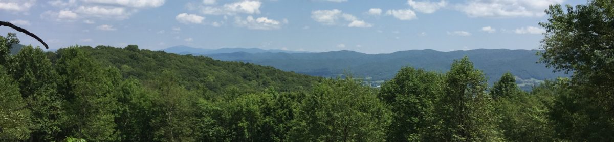
Our destination for the evening was Sassafras Gap Shelter, 6.9 miles away. Along the way, we passed a monument to Wade Sutton, an NC Forest Service Ranger who died fighting a forest fire nearby in 1968. The monument was festooned with loose change, rocks, and other trinkets. This will not be the only such monument we will pass as we make our way to Maine. We made it to the shelter and met a few new hikers including a pleasant lady called Pushing 60. The shelter was situated so that the “cooking platform” had benches that allowed us to look out of the shelter and down into the valley below. Gavin and I both stayed in the shelter because there were so few people there that night. It was good to not have to hassle with pitching my tent.
The next day we set out for Brown Fork Gap Shelter. This was our longest day of hiking in quite a while, at 9.1 miles. Thankfully, most all the day was spent hiking in and around the bases of mountains with easy terrain. The climbs were few and gentle UNTIL…. Near the end of the day, when we were almost spent, we started a section of the trail called Jacob’s Ladder. This was a section we had been warned about early on by Santa from Atlanta. It was a tail-kicker. Never mind the switchbacks. It went straight up. And up. And then up some more. Just when we thought we were about to reach the top (silly us), it went up even more. This was hands-down the most difficult and vertical climb we have made, even considering the haul up Albert Mountain. I hope we don’t have to deal with anything like that again until New Hampshire.

When we got to the shelter, there was not much room left. Gavin was able to secure a spot, but I wound up walking down into a valley beside the shelter to find ground flat enough to pitch a tent. Thankfully, this spot was near the water source. Before I bedded down, there were two more tents pitched beside mine. It was at this shelter that I was able to catch my first marvelous sunset. It was truly phenomenal. The temperature dropped to the 20’s, but we all slept warmly.
By the time I got my stuff packed up the next morning and went up to wake Gavin, all the other hikers had gone except Travis. I am appreciative that he and I seem to operate on the same sort of sleeping and hiking schedules. I usually set my alarm for 8:00 and wind up hitting the snooze button for an hour. I’ve really got to get better about that. I really don’t understand why I can’t get going in the mornings after I’ve had 12-13 hours of sleep, but it is a challenge nonetheless. Gavin is a whole other story. It usually takes him about the same amount of time to get up and get moving. I appreciate the nights we are able to stay in a shelter together so that I can get him started a little earlier.
Before Gavin was up and around, another couple had walked into the shelter. They are from Dallas and were just beginning their hike. They did the Georgia section back in October, so they were picking up where they left off. Gavin didn’t even get to meet them, but we’ll see them farther up the trail.

Needless to say, after having made the climb up Jacob’s Ladder, we were still tired and a bit sore. Our day of hiking to Cable Gap Shelter was one of our shortest, at 6.3 miles. I haven’t mentioned the weather much, but with the fear of jinxing our next week, we’ve had wonderful hiking weather the past several days. Though it has been much cooler at night, the days have been sunny and warm enough to hike in a light shirt. Today’s trip was another meandering stroll through the woods. No big climbs or descents to speak of. It was the kind of day of hiking I’d love to have many of.
We reached Cable Gap Shelter much earlier in the day than we normally arrive at camp. The couple I met earlier in the morning was already there as were a few others including Scout, who was able to witness my first true fall on the trail. I had just finished videoing and putting my phone back into its holster on my pack strap when my left foot hit a slick muddy spot and I went down. I am grateful that I missed the jagged rock that was sticking out of the ground near where I fell.

No sooner had we arrived at the shelter then Gavin asked, “Does anybody here play D & D?” Looking around at the folks, I expected a chorus of no’s, but the lady from Dallas (Happy) said, “Funny you should ask— his trail name is D-20.” It turns out that her husband was one of the early creators of the game, and he is still actively developing parts of it. After camp was made, Gavin and I were treated to having him lead us on a short campaign. It was truly a magical moment for Gavin.
Though I wasn’t too tired to do so, I decided not to pitch my tent in favor of securing a wall spot in the shelter. Before too long, some of the folks there had a good fire going out front and it was nice being able to visit and swap stories with the other hikers who arrived later that afternoon. Pushing 60 was there, and we were also graced with the presence of Sam, Odie, and a few others. Odie thru-hiked last year, so it was helpful to hear of some his adventures up the trail. It sounds like the early parts of the Smokies are going to be a bit difficult.
We were able to get up and out a little quicker today. Oddly enough, Gavin woke before I did, but he wound up getting back in his bag for a while. We got our breakfast, packed our bags, and had one of our earliest starts of the trip, hiking by 10:30.
With the goal of making it to Fontana Dam and The Lodge at Fontana Village, we set out – uphill. The climb lasted only an hour, and at the top we were caught by some old friends: Kevin (Goat), MJ (Sunkist), and Catherine (So Far, So Good.) We met them in the early days of our hike and expected that they would be well ahead of us. It turns out that they spent a few days in Asheville sightseeing and nursing an injury. We hiked with them most of the day today. It was really neat to see Gavin mix back in with them. Goat and I took the lead (Travis is just too fast for me to keep up with on the uphills), and Gav and the ladies hiked behind. So Far, So Good is the one who gave Gavin his trail name early on. She was in one of our early videos (Day 7 to be exact).

We made it down to the bathroom area at Fontana Lake, but we decided to push it on another 1.5 miles or so to the dam so that we wouldn’t have to hike it tomorrow. It was a good decision, though Gavin didn’t appreciate it at the time. Along the way, we passed the shelter known as the Fontana Hilton because there are showers nearby, running water, and a solar-powered charging station for devices. Based on conversations we heard last night, I believe the shelter was going to be pretty packed, and probably with partiers, so it was just as well that we had planned to stay at The Lodge.
After touring the dam briefly, we eventually got a shuttle to the hotel. It took some doing, though. Down at the dam, there was zero cell signal. We had to walk a few tenths of a mile back uphill to make the call. In under 15 minutes, we were whisked up and were on our way to the great indoors!
And that is where I am now. We have all showered, had our cheeseburgers, and are charging our devices. Tomorrow we will cross Fontana Dam and enter the Great Smoky Mountains National Park. This is the only section of the trail where you have to purchase and carry a permit. I was able to use a computer terminal in the lobby to secure ours. I am going to try to upload one or two more videos tonight and then I’m going to bed. We have a steep day ahead of us tomorrow climbing away from the dam.
As always, thanks so much for taking this trip with us. It has been truly amazing for us to be supported by so many folks, some of whom we know, but many of whom we don’t. We’re hoping to get into Gatlinburg sometime mid-week where I hope to make another entry. I am also trying to get videos out as often as possible. We’re still hamstrung by the in camp/want to eat/want to sleep problem, but finding strong enough WiFi to upload videos has been a challenge as well. At any rate, know that you are appreciated and your comments are meaningful to us. Also, remember to just keep taking the Next Step…
Met a few thru hikers on the balds past Roan Mountain yesterday who started earlier in February than you, they went thru Smokies in rain, snow and ice, hope y’all have better weather thru there
We should be okay for the next few days. Heard there was a little ice out there.
Jacob’s Ladder is a killer! Can’t wait to read your next section. I hope you’re planning to stay at the Fontana ” Hilton ” shelter. There’s no better shelter EVER! Hehe! ~ Plodding Bison
We passed it by in favor of The Lodge in the village. It was going to be inhabited by a large group of party animals last night so we came on here in favor of a good nights of sleep.
I love reading about your adventure. It really is very inspiring. I hope you have decent weather through the smokies.
Great to read your updates and watch the videos. I hope you both continue to be healthy and injury free!
Enjoy reading all the happenings, sounds like a great trip. Waiting to see what’s next
Always enjoy reading your posts. Thought of you two last week when visiting some friends in Clayton, GA, over the weekend. Had a family home in Franklin for 40 years until selling it 19 months ago, but before selling it would get up to Wayah Bald and enjoy the fantastic views. Seemed it was just about always windy up there. Still have friends in Franklin so I’m able to visit whenever I want.
Plan on starting my own Appalachian Trail adventure (with three buddies) the week of April 29th for a section hike beginning at Springer and probably (hopefully) getting to Blood Mtn before the week’s end. This will be a fund raiser hike to benefit the school where I’m employed. Being an educator and still working, my time is limited but try to always make the most of any available free time. Hike on you two! It’s fun watching your progress.
Thanks for following along. Wayah was cold and windy- should have worn my puffy jacket up so I could have enjoyed it more. Best view so far was from Rocky Top! Clingman’s was Good, but a little cloudy in the distance.
I appreciate you keeping us up to date with your adventure!
I reread your posts about the two steeps ascents. Climbing Roan High Bald from the south will be a buttkicker about 200 more miles up the trail, I went down it many years ago on a short backpacking trip and remember thinking how hard it would be to go up it, the reward will be the next 10-15 miles afterwards are unbelievably scenic in good weather. Also- Congratulations, when you come back into civilization again ( Clingmans Dome or Newfound Gap?) you’ll have far surpassed my total AT miles of about 180 miles, I never did more than 35 miles in any one trip as I usually backpacked for just a few nights. I’m probably closer to 30o total since I keep repeating the Roan Mountain and Carver’s Gap Balds area and the and the Wilburn Ridge hike around Grayson Highlands with the wild ponies . I keep bringing up places I go, but always know – I’m rooting (and praying) for the two of you and your adventure. It far surpasses all of my dayhiking.
We made 200 at Clingman’s yesterday. Rocky Top had the best uncloudy views so far. Looking forward to the Roan Highlands. Hopefully we’ll have our trail legs in earnest by then. We’ve done Grayson a couple of times, but it’ll be more special this time since we will be hiking in from a distance!
Rob we are enjoying following your and Gavin’s adventure. I find myself checking your where we are link often. Stay safe and keep making memories!
Thanks for the comment. We’re having a blast so far. We’ve had more rain than I’d like, but it has all been good.
That sunset!! Wow. I am excited when I get an email letting me know you’ve posted an entry. I have so enjoyed following along on your journey. May safe travels and pleasant weather be with you every step of the way!
Thanks so much. That sunset was absolutely awesome. Unfortunately, with Gavin and me, you won’t get many sunrises.
Hey guys, just checked the A T Weather web site for Mollies Ridge shelter for Friday. Highs in the 40’s lows in the 20’s. Also chance of snow. The climb out of Fontana going up Shuckstack is tough so take your time. Hoefully the weather thru the Smokies won’t be too bad an you can enjoy the views! Thanks so much for the posts. I can remember my section hikes every time I read them. Prayers for safety and enjoyment for each day.
We had a blast of sleet at Birch Spring Campsite on our first night in the Smokies. Otherwise, temps have been moderate and the weather has been great. Thanks for following us along!
Love reading your weekly report… Keep taking the next step Mr Duncan and Gavin..Can’t wait to read about it…
My class is enjoying following along with your travels. We have a bulletin board with a map and are plotting your travels. I am so proud of you both. What an awesome experience.
Thanks for following us. We’d like to do a Q & A video for you guys sometime if you can send me some questions.